The cuestas of São Paulo
The basalt step
Record, downloads and citationIn the middle of the state, the western São Paulo plateau ends in a step: the cuestas, scarps where the layers of basalt and sandstone break off all at once, facing the Peripheral Depression. Profile A–B leaves the depression near São Pedro, at 500 m, rises to a first plateau at 956 m, dips into a valley at 537 m and climbs the Itirapina cuesta: 543 m of climb in 5 km, up to 1,081 m. On the far side, the ground falls to the Corumbataí valley, at around 640 m. The highest point in the frame, 1,084 m, is right there, in Itirapina; between it and the lowest point lie 671 m. In the south-west, the Botucatu cuesta draws the same step. In the 15,399 km² frame, only 12.3% of the ground lies above 800 m. Third plate of the collection “The relief of São Paulo”.
Technical record · downloads · citation
At a glance
543 m
671 m
Layers
- relevo raster GeoTIFF of elevation in metres (90 m pixels) clipped to the frame, with the plate’s hypsometric ramp in a .qml style
- faixas_altitude polygon 7 elevation bands, every 100 m, with the area of each
- perfil line The A–B profile line, 57.2 km
- ponto_mais_alto point Highest point in the frame, 1,084 m, in Itirapina
- municipios polygon The 58 municipalities in the frame
Metadata
- Sources
- Copernicus DEM GLO-90 (ESA, European Union), digital surface model, 90 m pixels
WWF / HydroSHEDS — HydroRIVERS v1.0, South America (Lehner and Grill, 2013)
IBGE — Municipal Mesh 2025 (2025) - Extent
- Central São Paulo state, between Jaú, São Carlos, Piracicaba and Botucatu (SP)
- CRS / Projection
- SIRGAS 2000 (EPSG:4674)
EPSG:4674 - Software
- Python · rasterio · GeoPandas · SciPy · GDAL · QGIS · Node.js · d3-geo
- Method
- Copernicus DEM GLO-90 tiles mosaicked, lit from the north-west with relief exaggerated 4 times and coloured by elevation band; profile A–B sampled at 600 points, drawn through the frame’s steepest local relief.
- Version
- v1.0.0
- Licence
- CC BY 4.0
Downloads
- GPKG Elevation bands, profile, highest point and municipalities, SIRGAS 2000, with QGIS styles (.gpkg) 1.1 MB
- TIF Elevation in the frame (GeoTIFF, 90 m) with a .qml style (.tif) 1.7 MB
- CSV Profile A–B: 600 points with distance, coordinates and elevation (.csv) 19 kB
- SVG Vector plate, for printing (.svg) 3.8 MB
- PNG Plate (PNG, 2400 px) (.png) 2.3 MB

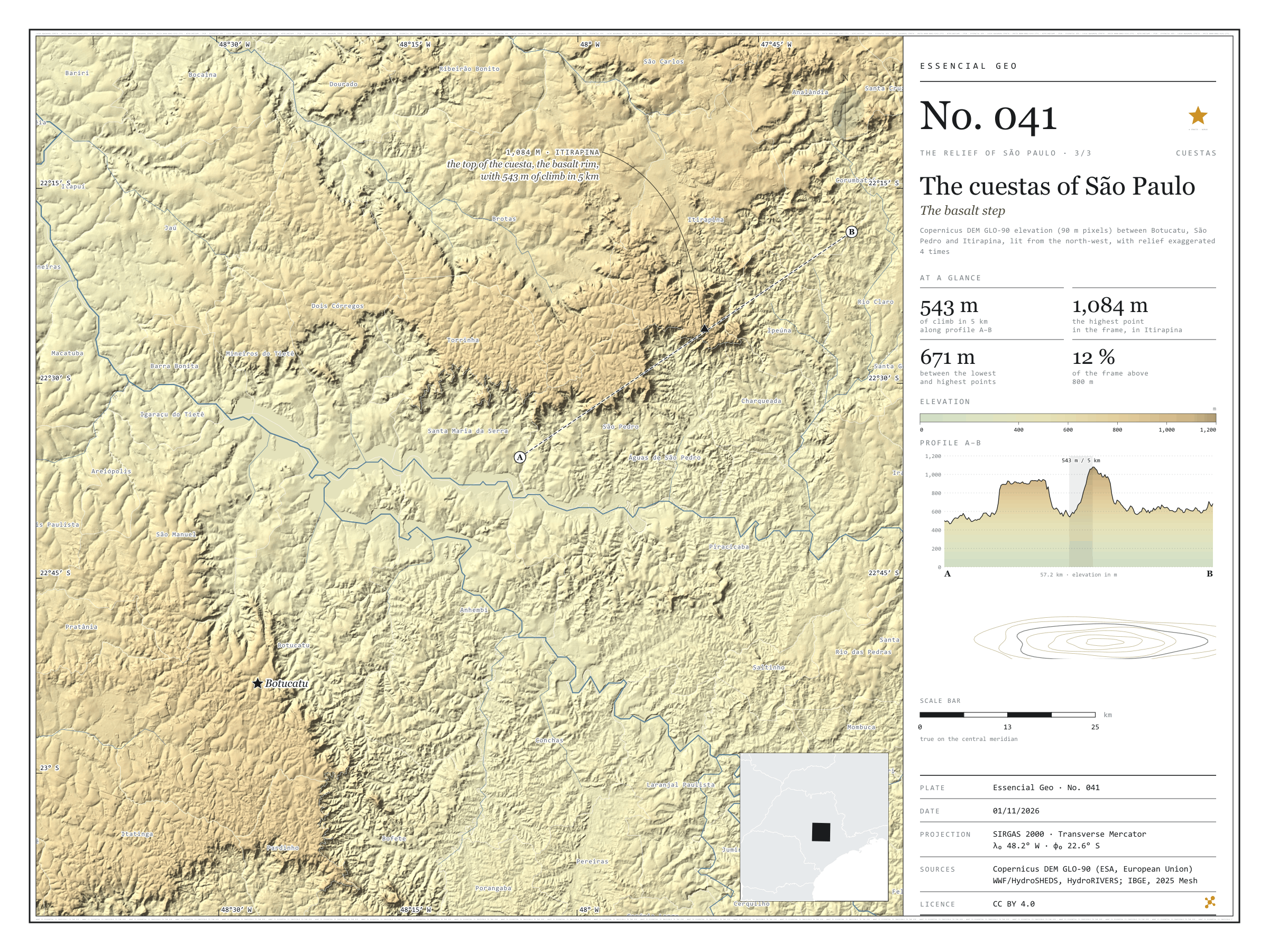
Figure to reuse
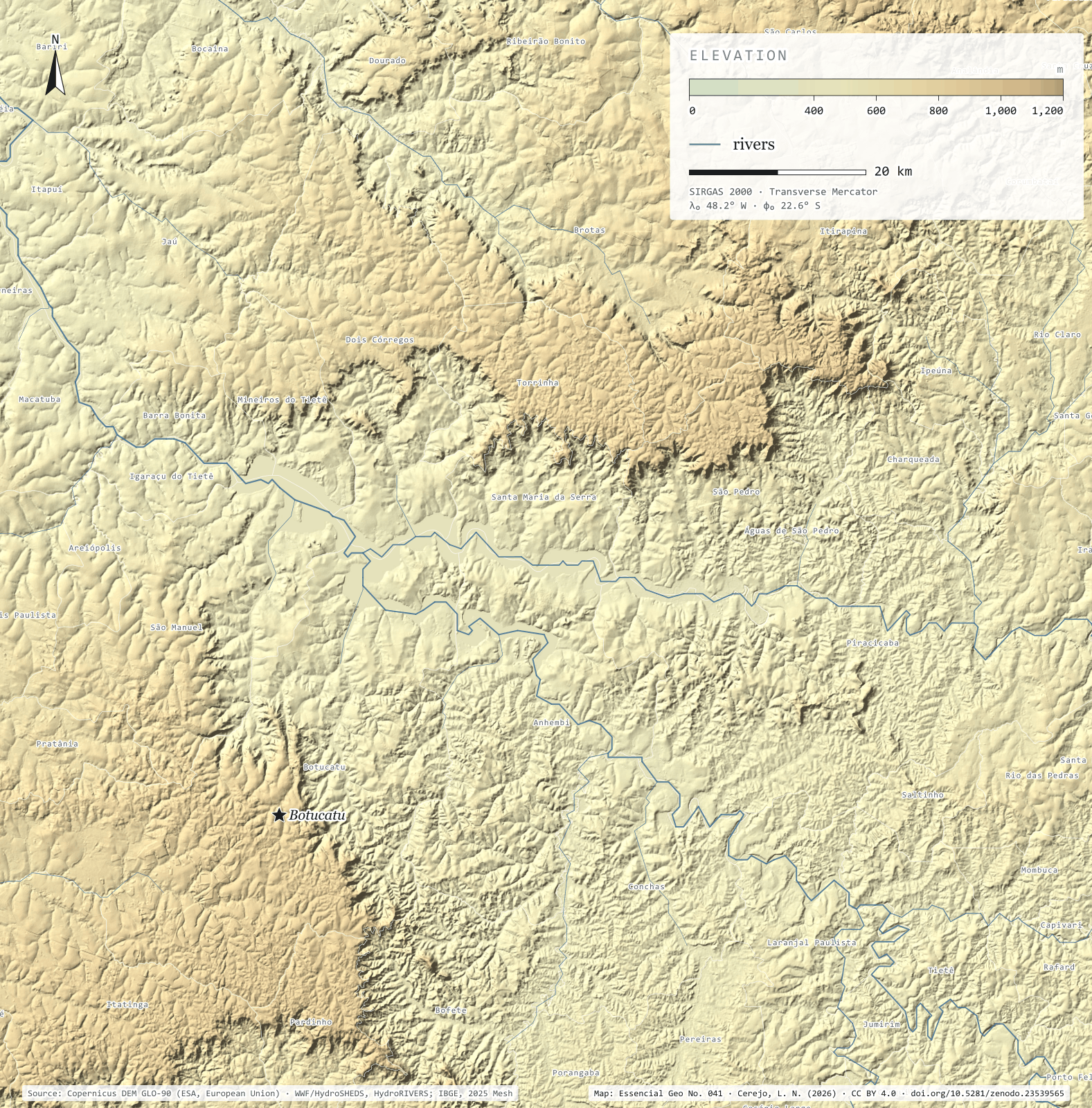
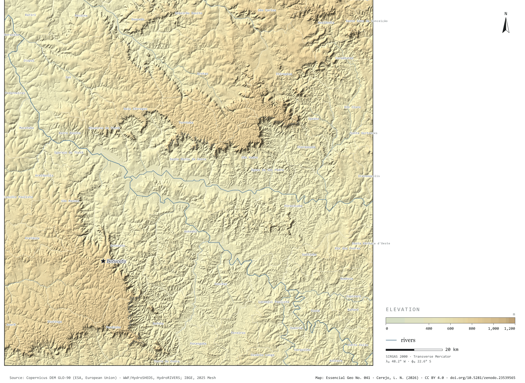
The map without a frame, with legend, scale, reference system and credit written on it: ready for papers, lectures and slides. In two versions: with the basemap (neighbours and sea) or only the mapped area, on white.
With basemap (PNG) Without basemap (PNG) QR code (SVG)
Point a camera at it to open this page.
How to cite
CEREJO, Lucas Nakamura. Cuestas paulistas: o degrau do basalto. Versão 1.0.0. [S. l.]: Zenodo, 2026. Conjunto de dados. DOI: 10.5281/zenodo.23539565. Disponível em: https://doi.org/10.5281/zenodo.23539565. Acesso em: 10 nov. 2026.
Cerejo, L. N. (2026). Cuestas paulistas: o degrau do basalto [The cuestas of São Paulo: The basalt step] (Version 1.0.0) [Data set]. Zenodo. https://doi.org/10.5281/zenodo.23539565
@dataset{cerejo2026_cuestas_paulistas,
  author    = {Cerejo, Lucas Nakamura},
  title     = {Cuestas paulistas: O degrau do basalto},
  year      = {2026},
  publisher = {Zenodo},
  version   = {1.0.0},
  doi       = {10.5281/zenodo.23539565},
  url       = {https://doi.org/10.5281/zenodo.23539565},
  language  = {portuguese},
  note      = {English title: The cuestas of São Paulo: The basalt step. Licence CC BY 4.0}
}