Skip to content
Essencial

Essencial: Cartographic feed · Sheet 12 of 12

Thematic maps of Brazil, in weekly collections. Each plate comes with its layers, a declared projection and a citation with a DOI.

No. 004 Territorial divisions Brazil, state by state 4/27

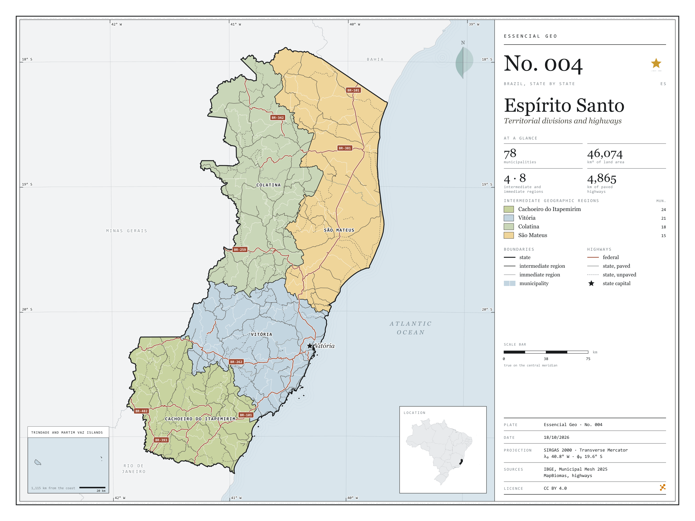
Espírito Santo

Territorial divisions and highways

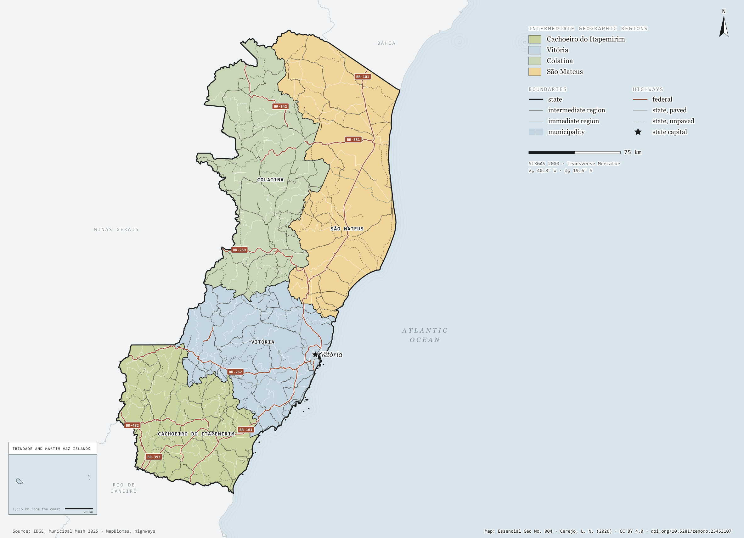
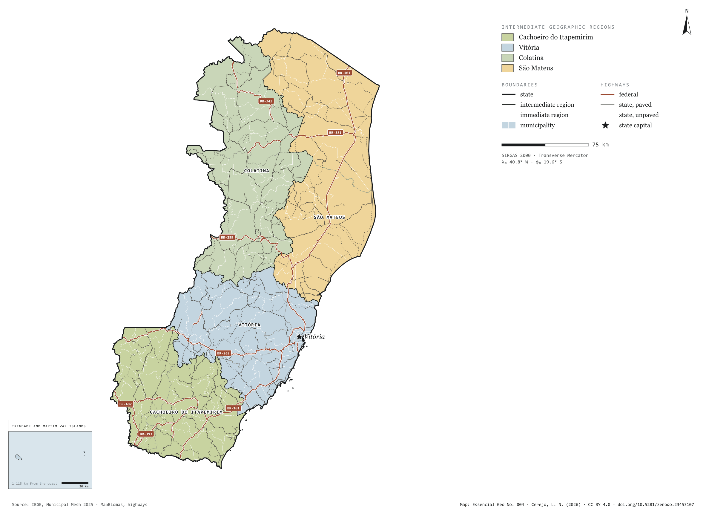
Fig. 004 Espírito Santo state (ES) EPSG:4674 Source: IBGE, MapBiomas, Natural Earth

Espírito Santo has 78 municipalities across 46,000 km², 0.5 per cent of Brazil. IBGE groups them into 8 immediate regions, drawn around the towns that supply jobs, trade and services to their surroundings, and into 4 intermediate regions that tie those networks together. Cachoeiro do Itapemirim is the intermediate region with the most municipalities (24); São Mateus, the one with the fewest (15). The largest municipality is Linhares (3,496 km²); the smallest, Piúma (74 km²). Part of the series “Brazil, state by state”: a clean base, with official boundaries and the road network, to start a map without losing the first afternoon gathering files.

Technical record · downloads · citation

At a glance

Municipalities per intermediate region (municipalities)
  • Cachoeiro do Itapemirim 24
  • Vitória 21
  • Colatina 18
  • São Mateus 15
Area

46,074 km²

Largest municipality: Linhares (3,496 km²); smallest: Piúma (74 km²)

Paved highways

4,865 km

1,241 km federal and 5,731 km state highways, paved or not

Layers

  • municipios polygon 78 municipalities, with IBGE code, regions, urban concentration and area (km²)
  • regioes_intermediarias polygon 4 intermediate geographic regions
  • regioes_imediatas polygon 8 immediate geographic regions
  • limite_estadual polygon Boundary of the federative unit
  • rodovias line Federal and state highways: route number, surface, physical status, carriageways
  • capital point Indicative point for the capital (not the exact seat)

Metadata

Extent
Espírito Santo state (ES)
CRS / Projection
SIRGAS 2000 (EPSG:4674)
EPSG:4674
Software
Python · GeoPandas · GDAL · QGIS · Node.js · d3-geo
Method
IBGE Municipal Mesh boundaries, dissolved into immediate and intermediate regions and the unit boundary; highways clipped to the unit.
Version
v1.0.0
Licence
CC BY 4.0

Downloads

Figure to reuse

The map without a frame, with legend, scale, reference system and credit written on it: ready for papers, lectures and slides. In two versions: with the basemap (neighbours and sea) or only the mapped area, on white.

Point a camera at it to open this page.

How to cite

Cerejo, L. N. (2026). Espírito Santo: divisão territorial e rodovias [Espírito Santo: Territorial divisions and highways] (Version 1.0.0) [Data set]. Zenodo. https://doi.org/10.5281/zenodo.23453107

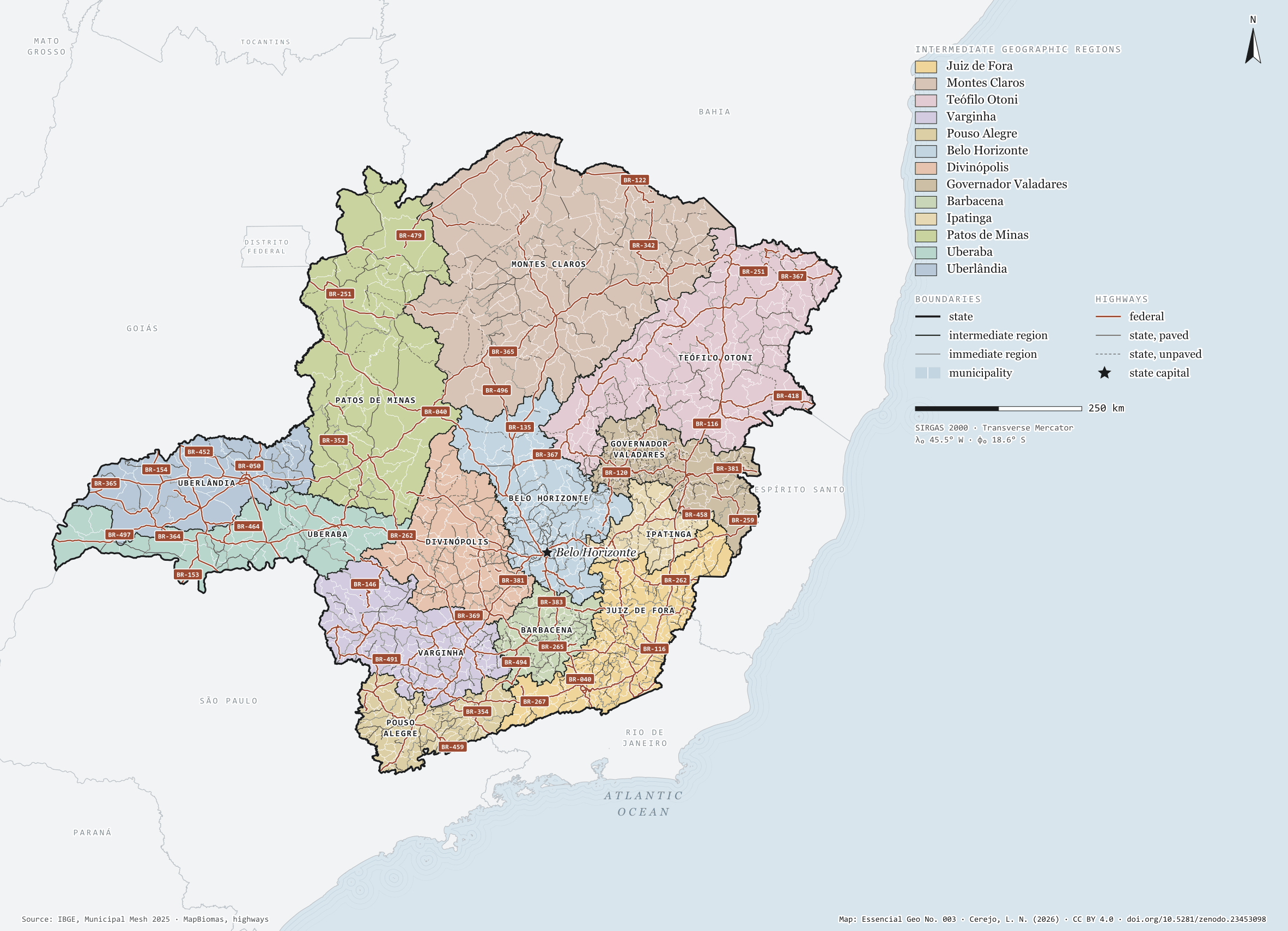
No. 003 Territorial divisions Brazil, state by state 3/27

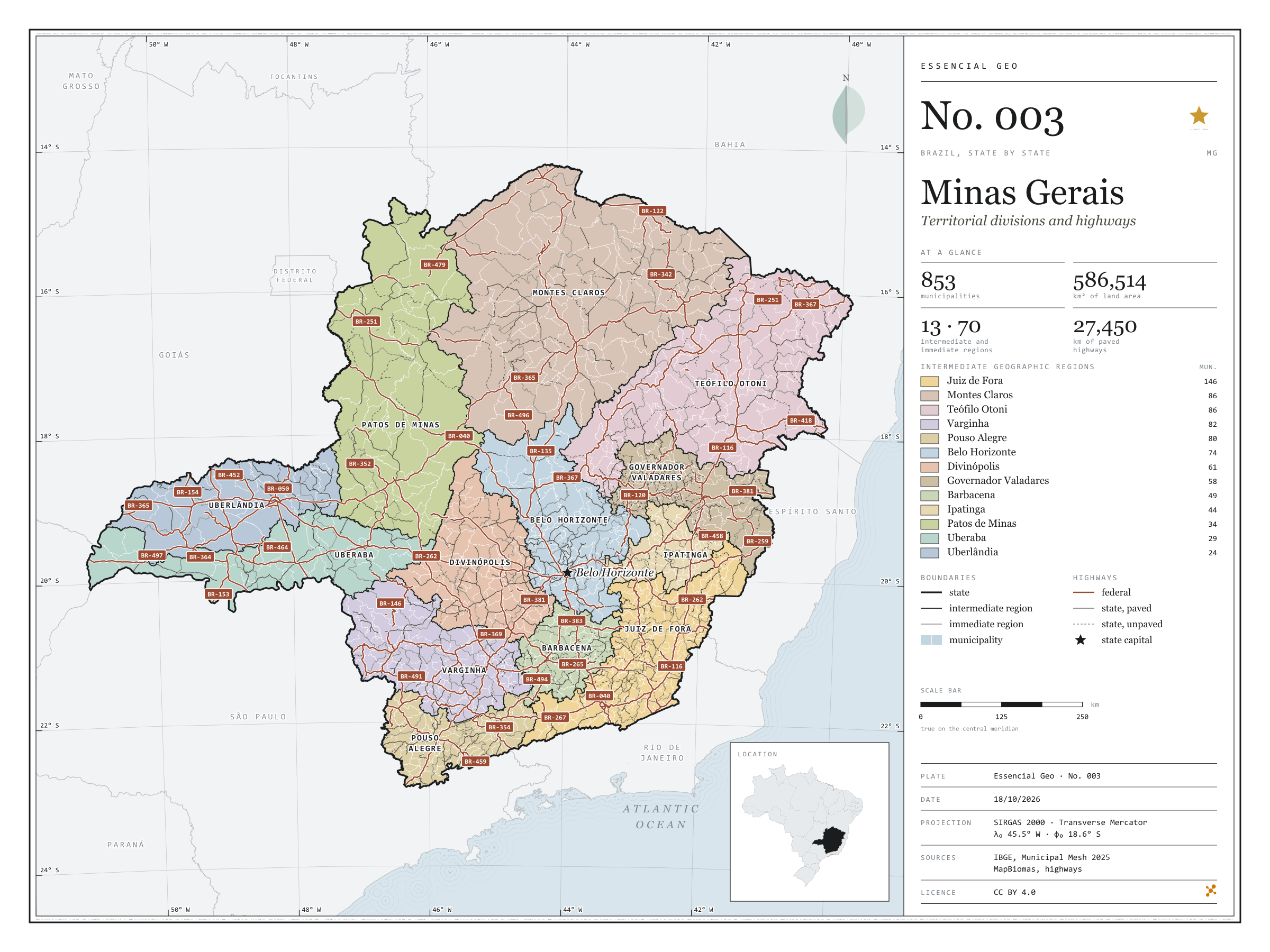
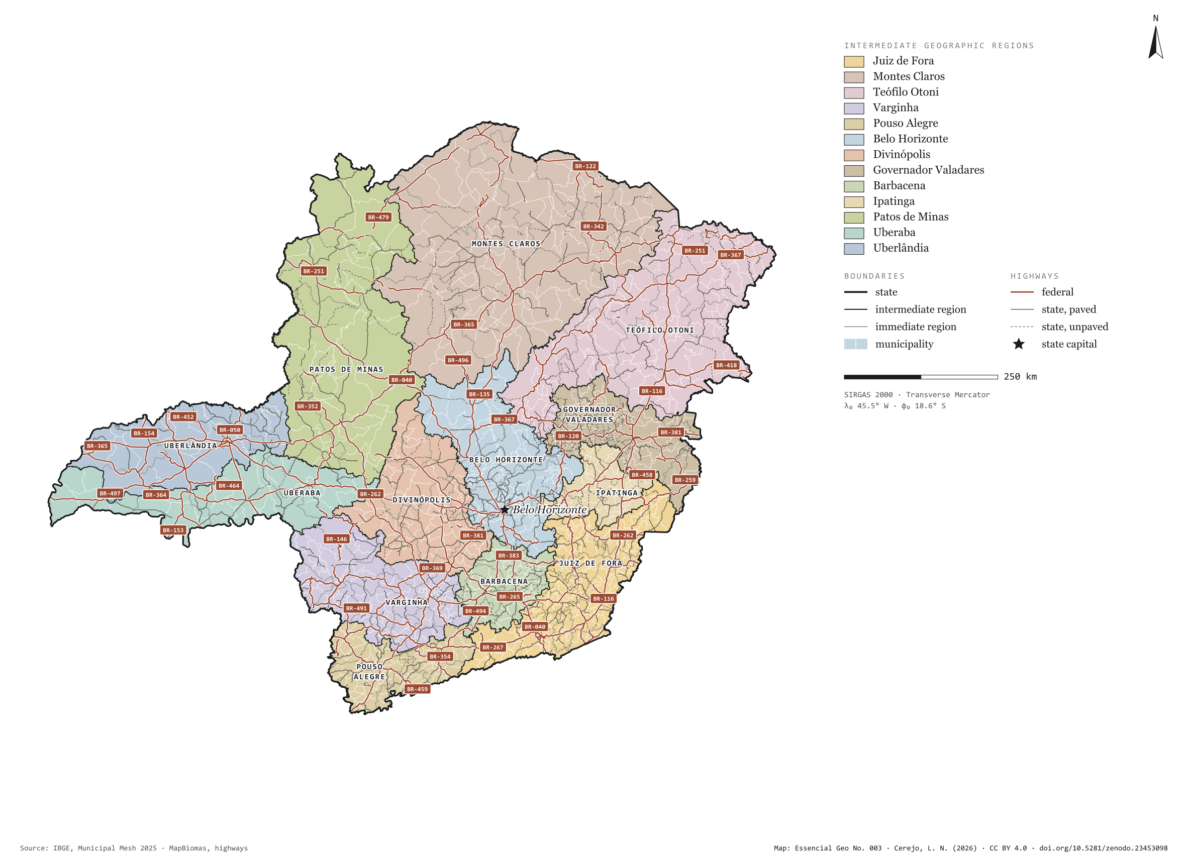
Minas Gerais

Territorial divisions and highways

Fig. 003 Minas Gerais state (MG) EPSG:4674 Source: IBGE, MapBiomas, Natural Earth

Minas Gerais has 853 municipalities across 587,000 km², 6.9 per cent of Brazil. IBGE groups them into 70 immediate regions, drawn around the towns that supply jobs, trade and services to their surroundings, and into 13 intermediate regions that tie those networks together. Juiz de Fora is the intermediate region with the most municipalities (146); Uberlândia, the one with the fewest (24). The largest municipality is João Pinheiro (10,727 km²); the smallest, Santa Cruz de Minas (3.6 km²). Part of the series “Brazil, state by state”: a clean base, with official boundaries and the road network, to start a map without losing the first afternoon gathering files.

Technical record · downloads · citation

At a glance

Municipalities per intermediate region (municipalities)
  • Juiz de Fora 146
  • Montes Claros 86
  • Teófilo Otoni 86
  • Varginha 82
  • Pouso Alegre 80
  • Belo Horizonte 74
  • Divinópolis 61
  • Governador Valadares 58
  • Barbacena 49
  • Ipatinga 44
  • Patos de Minas 34
  • Uberaba 29
  • Uberlândia 24
Area

586,514 km²

Largest municipality: João Pinheiro (10,727 km²); smallest: Santa Cruz de Minas (3.6 km²)

Paved highways

27,450 km

14,980 km federal and 20,772 km state highways, paved or not

Layers

  • municipios polygon 853 municipalities, with IBGE code, regions, urban concentration and area (km²)
  • regioes_intermediarias polygon 13 intermediate geographic regions
  • regioes_imediatas polygon 70 immediate geographic regions
  • limite_estadual polygon Boundary of the federative unit
  • rodovias line Federal and state highways: route number, surface, physical status, carriageways
  • capital point Indicative point for the capital (not the exact seat)

Metadata

Extent
Minas Gerais state (MG)
CRS / Projection
SIRGAS 2000 (EPSG:4674)
EPSG:4674
Software
Python · GeoPandas · GDAL · QGIS · Node.js · d3-geo
Method
IBGE Municipal Mesh boundaries, dissolved into immediate and intermediate regions and the unit boundary; highways clipped to the unit.
Version
v1.0.0
Licence
CC BY 4.0

Downloads

Figure to reuse

The map without a frame, with legend, scale, reference system and credit written on it: ready for papers, lectures and slides. In two versions: with the basemap (neighbours and sea) or only the mapped area, on white.

Point a camera at it to open this page.

How to cite

Cerejo, L. N. (2026). Minas Gerais: divisão territorial e rodovias [Minas Gerais: Territorial divisions and highways] (Version 1.0.0) [Data set]. Zenodo. https://doi.org/10.5281/zenodo.23453098

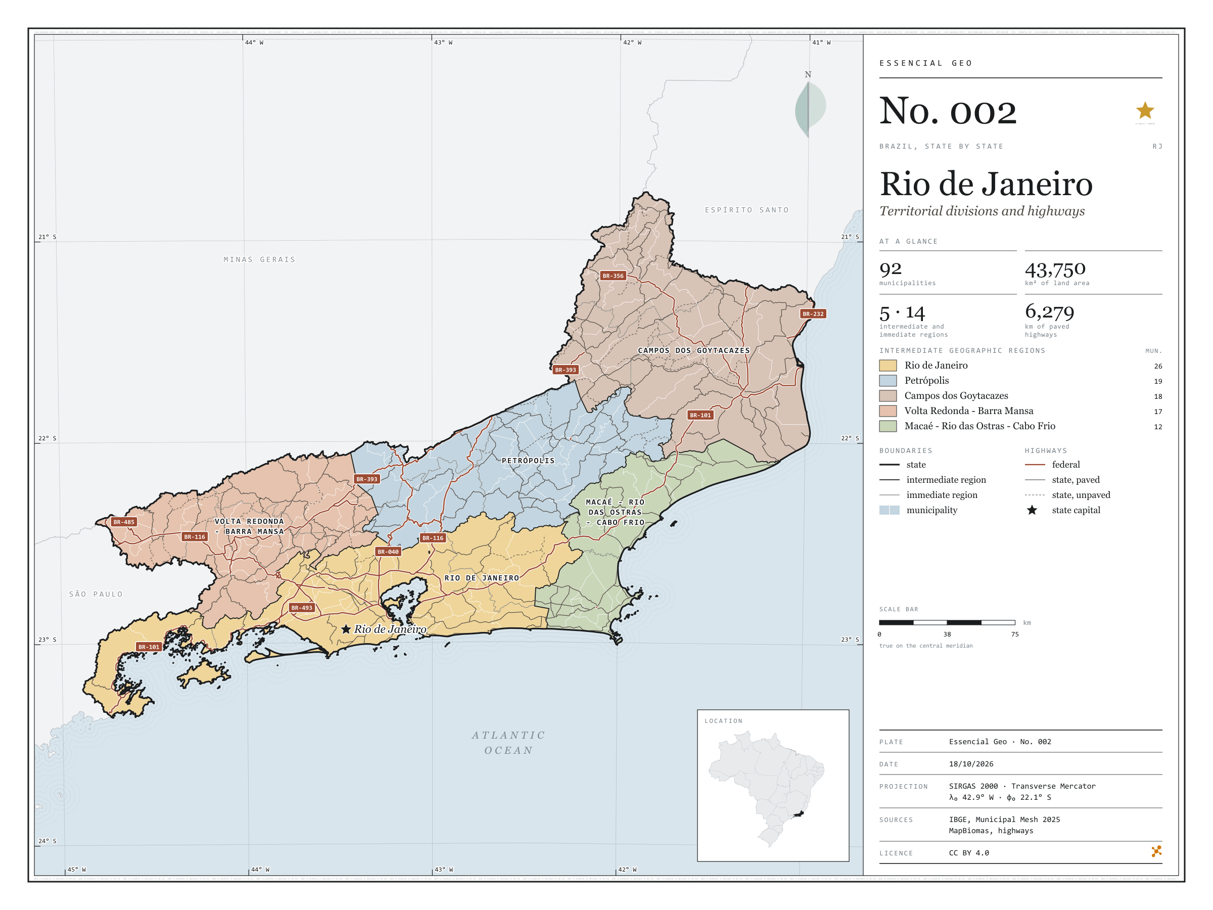
No. 002 Territorial divisions Brazil, state by state 2/27

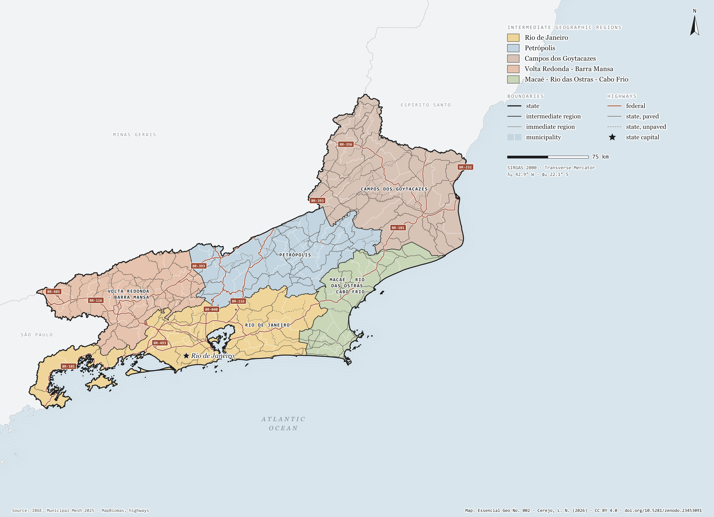
Rio de Janeiro

Territorial divisions and highways

Fig. 002 Rio de Janeiro state (RJ) EPSG:4674 Source: IBGE, MapBiomas, Natural Earth

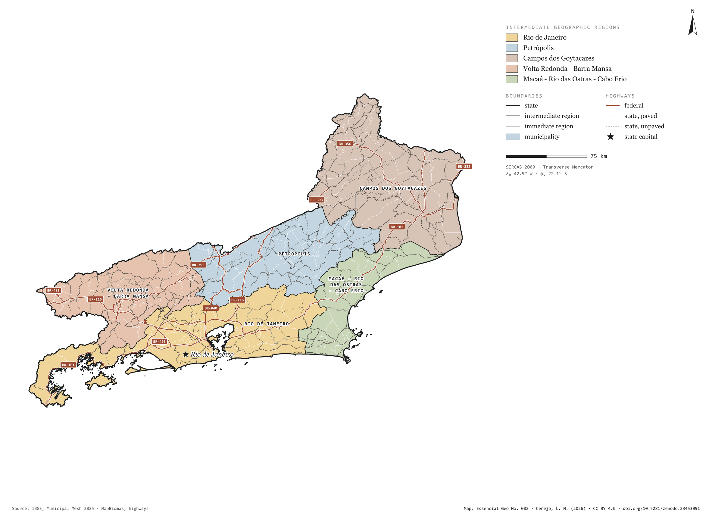
Rio de Janeiro has 92 municipalities across 44,000 km², 0.5 per cent of Brazil. IBGE groups them into 14 immediate regions, drawn around the towns that supply jobs, trade and services to their surroundings, and into 5 intermediate regions that tie those networks together. Rio de Janeiro is the intermediate region with the most municipalities (26); Macaé - Rio das Ostras - Cabo Frio, the one with the fewest (12). The largest municipality is Campos dos Goytacazes (4,033 km²); the smallest, Nilópolis (19 km²). Part of the series “Brazil, state by state”: a clean base, with official boundaries and the road network, to start a map without losing the first afternoon gathering files.

Technical record · downloads · citation

At a glance

Municipalities per intermediate region (municipalities)
  • Rio de Janeiro 26
  • Petrópolis 19
  • Campos dos Goytacazes 18
  • Volta Redonda - Barra Mansa 17
  • Macaé - Rio das Ostras - Cabo Frio 12
Area

43,750 km²

Largest municipality: Campos dos Goytacazes (4,033 km²); smallest: Nilópolis (19 km²)

Paved highways

6,279 km

1,739 km federal and 5,469 km state highways, paved or not

Layers

  • municipios polygon 92 municipalities, with IBGE code, regions, urban concentration and area (km²)
  • regioes_intermediarias polygon 5 intermediate geographic regions
  • regioes_imediatas polygon 14 immediate geographic regions
  • limite_estadual polygon Boundary of the federative unit
  • rodovias line Federal and state highways: route number, surface, physical status, carriageways
  • capital point Indicative point for the capital (not the exact seat)

Metadata

Extent
Rio de Janeiro state (RJ)
CRS / Projection
SIRGAS 2000 (EPSG:4674)
EPSG:4674
Software
Python · GeoPandas · GDAL · QGIS · Node.js · d3-geo
Method
IBGE Municipal Mesh boundaries, dissolved into immediate and intermediate regions and the unit boundary; highways clipped to the unit.
Version
v1.0.0
Licence
CC BY 4.0

Downloads

Figure to reuse

The map without a frame, with legend, scale, reference system and credit written on it: ready for papers, lectures and slides. In two versions: with the basemap (neighbours and sea) or only the mapped area, on white.

Point a camera at it to open this page.

How to cite

Cerejo, L. N. (2026). Rio de Janeiro: divisão territorial e rodovias [Rio de Janeiro: Territorial divisions and highways] (Version 1.0.0) [Data set]. Zenodo. https://doi.org/10.5281/zenodo.23453091

No. 001 Territorial divisions Brazil, state by state 1/27

São Paulo

Territorial divisions and highways

Fig. 001 São Paulo state (SP) EPSG:4674 Source: IBGE, MapBiomas, Natural Earth

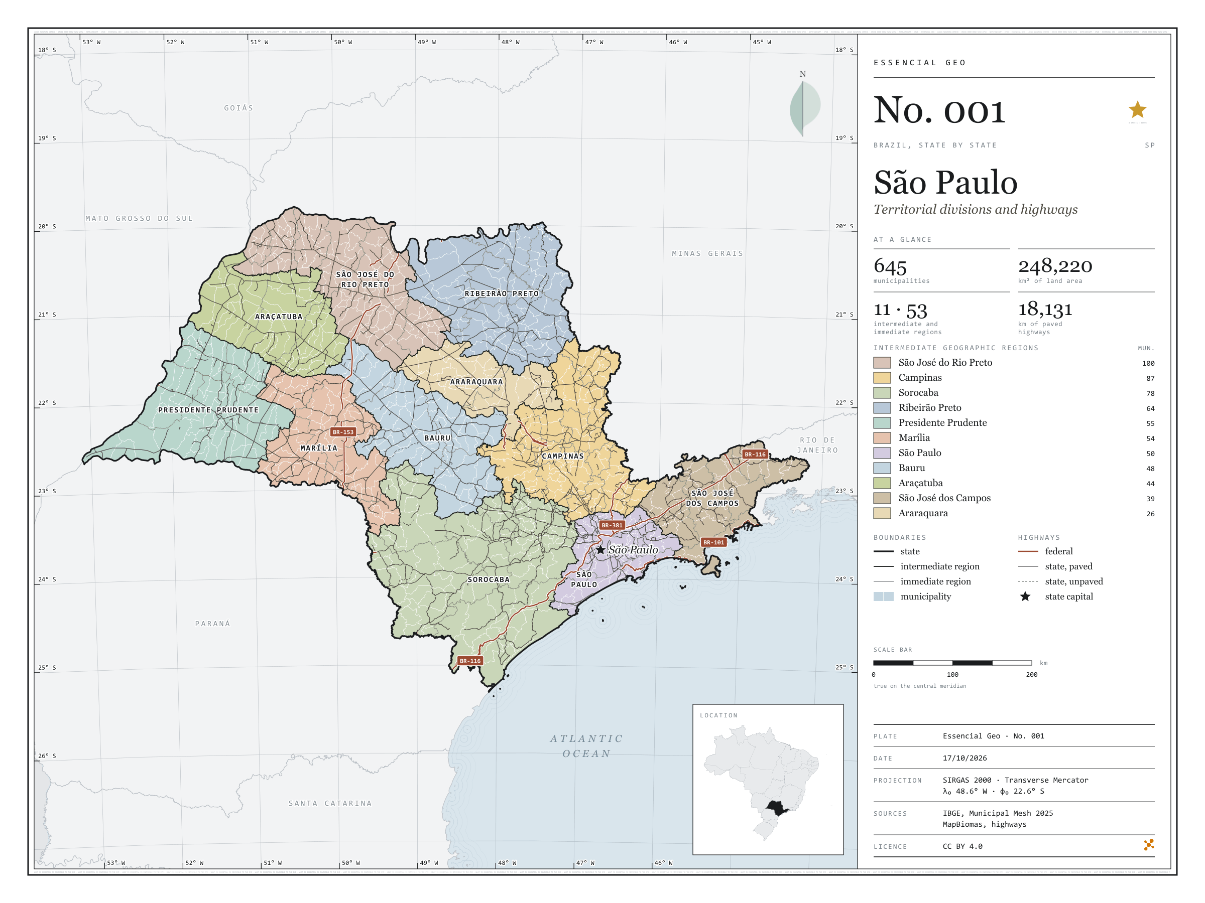
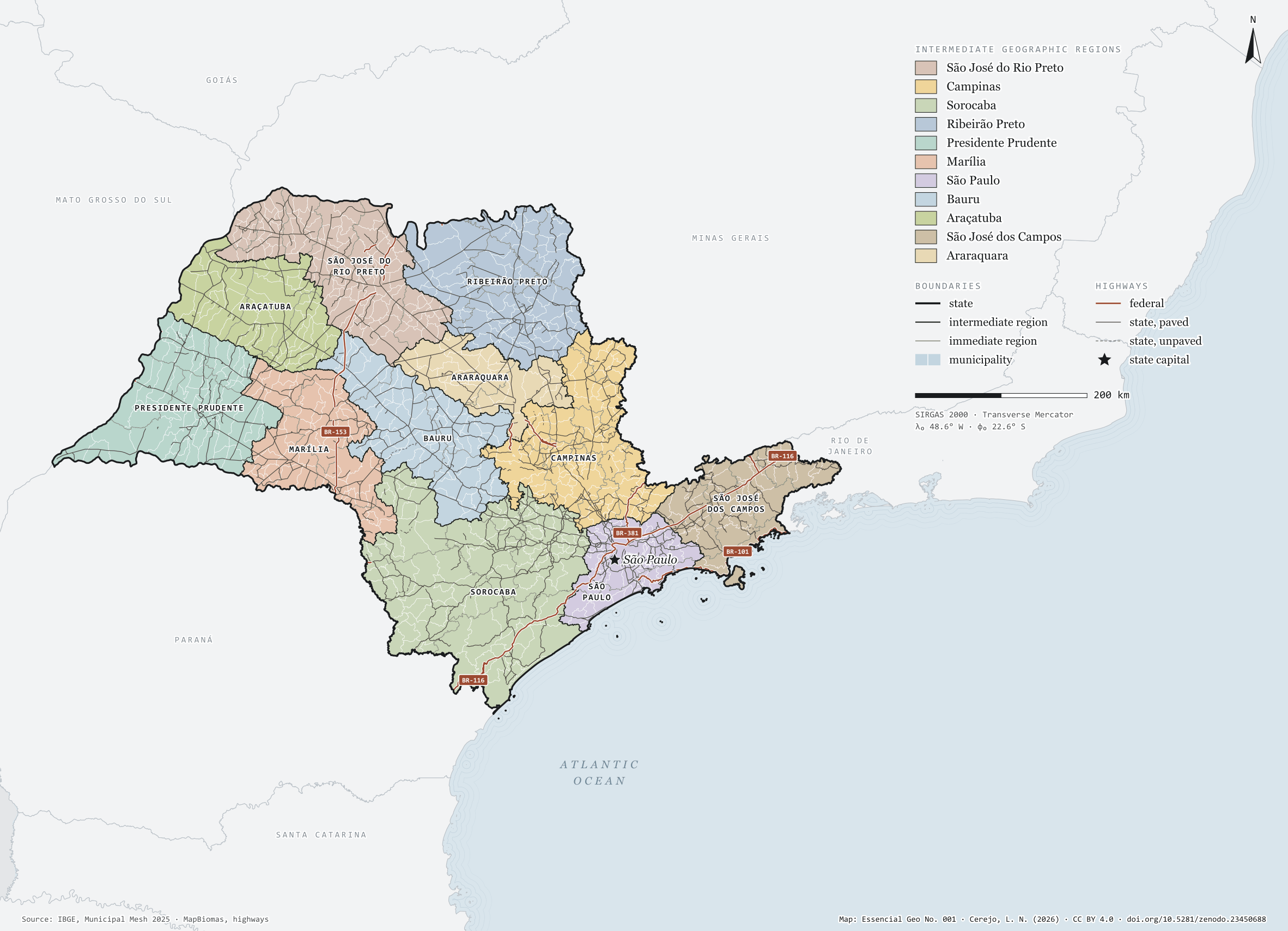
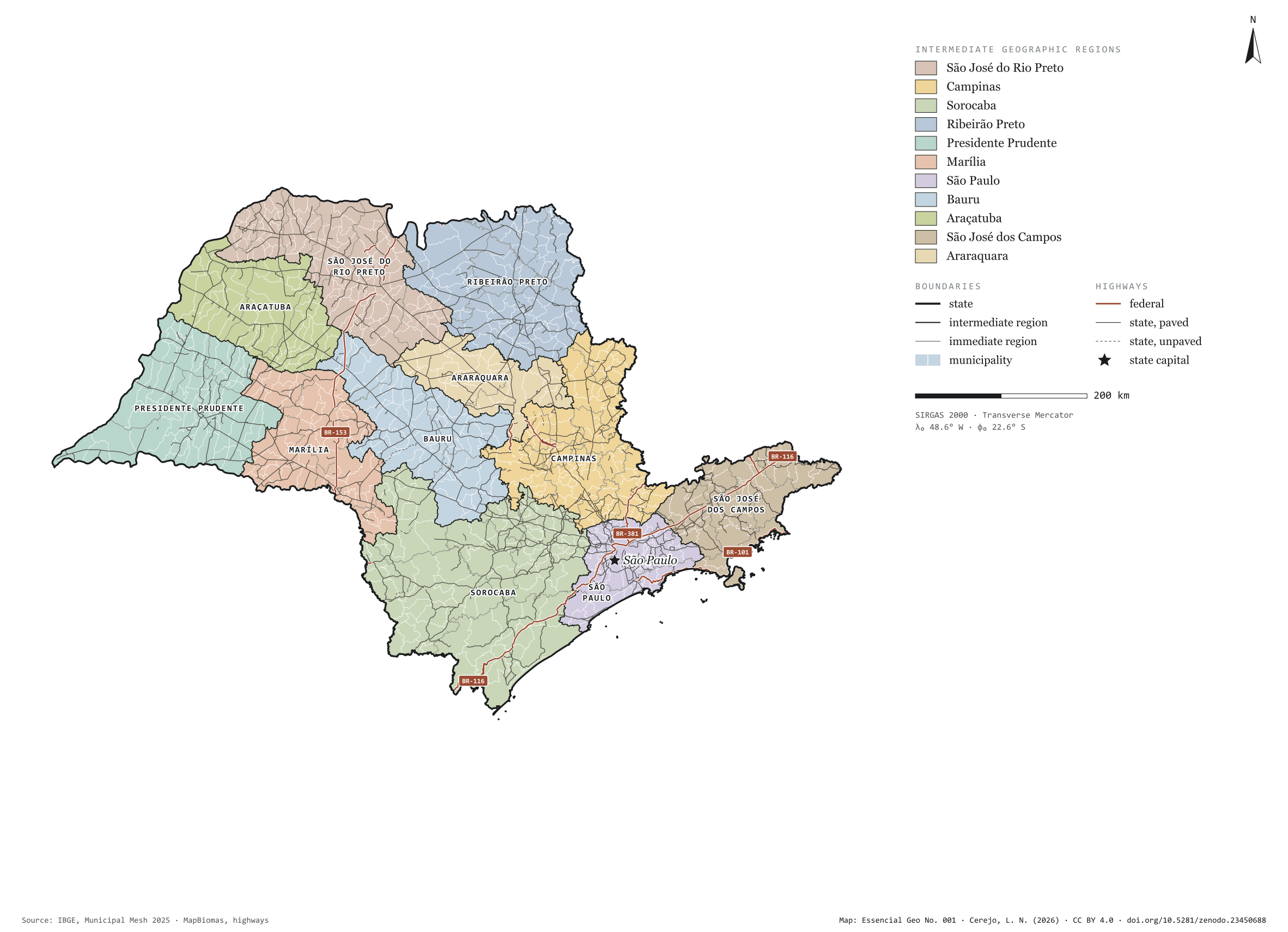
São Paulo has 645 municipalities across 248,000 km², almost three per cent of Brazil. IBGE groups them into 53 immediate regions, drawn around the towns that supply jobs, trade and services to their surroundings, and into 11 intermediate regions that tie those networks together. São José do Rio Preto, in the north-west, gathers a hundred small municipalities; São Paulo, fifty, nearly all pressed against the capital. This plate opens the series “Brazil, state by state”: a clean base, with official boundaries and the paved road network, for anyone who needs to start a map of the state without losing the first afternoon gathering files.

Technical record · downloads · citation

At a glance

Municipalities per intermediate region (municipalities)
  • São José do Rio Preto 100
  • Campinas 87
  • Sorocaba 78
  • Ribeirão Preto 64
  • Presidente Prudente 55
  • Marília 54
  • São Paulo 50
  • Bauru 48
  • Araçatuba 44
  • São José dos Campos 39
  • Araraquara 26
Area

248,220 km²

Largest municipality: Iguape (1,978 km²); smallest: Águas de São Pedro (3.4 km²)

Paved highways

18,131 km

1,402 km federal and 17,200 km state highways, paved or not

Layers

  • municipios polygon 645 municipalities, with IBGE code, regions, urban concentration and area (km²)
  • regioes_intermediarias polygon 11 intermediate geographic regions
  • regioes_imediatas polygon 53 immediate geographic regions
  • limite_estadual polygon Boundary of the federative unit
  • rodovias line Federal and state highways: route number, surface, physical status, carriageways
  • capital point Indicative point for the capital (not the exact seat)

Metadata

Extent
São Paulo state (SP)
CRS / Projection
SIRGAS 2000 (EPSG:4674)
EPSG:4674
Software
Python · GeoPandas · GDAL · QGIS · Node.js · d3-geo
Method
IBGE Municipal Mesh boundaries, dissolved into immediate and intermediate regions and the unit boundary; highways clipped to the unit.
Version
v1.0.0
Licence
CC BY 4.0

Downloads

Figure to reuse

The map without a frame, with legend, scale, reference system and credit written on it: ready for papers, lectures and slides. In two versions: with the basemap (neighbours and sea) or only the mapped area, on white.

Point a camera at it to open this page.

How to cite

Cerejo, L. N. (2026). São Paulo: divisão territorial e rodovias [São Paulo: Territorial divisions and highways] (Version 1.0.0) [Data set]. Zenodo. https://doi.org/10.5281/zenodo.23450688

Technical record

Technical record · No. 004

Espírito Santo

At a glance

Municipalities per intermediate region (municipalities)
  • Cachoeiro do Itapemirim 24
  • Vitória 21
  • Colatina 18
  • São Mateus 15
Area

46,074 km²

Largest municipality: Linhares (3,496 km²); smallest: Piúma (74 km²)

Paved highways

4,865 km

1,241 km federal and 5,731 km state highways, paved or not

Layers

  • municipios polygon 78 municipalities, with IBGE code, regions, urban concentration and area (km²)
  • regioes_intermediarias polygon 4 intermediate geographic regions
  • regioes_imediatas polygon 8 immediate geographic regions
  • limite_estadual polygon Boundary of the federative unit
  • rodovias line Federal and state highways: route number, surface, physical status, carriageways
  • capital point Indicative point for the capital (not the exact seat)

Metadata

Extent
Espírito Santo state (ES)
CRS / Projection
SIRGAS 2000 (EPSG:4674)
EPSG:4674
Software
Python · GeoPandas · GDAL · QGIS · Node.js · d3-geo
Method
IBGE Municipal Mesh boundaries, dissolved into immediate and intermediate regions and the unit boundary; highways clipped to the unit.
Version
v1.0.0
Licence
CC BY 4.0

Downloads

Figure to reuse

The map without a frame, with legend, scale, reference system and credit written on it: ready for papers, lectures and slides. In two versions: with the basemap (neighbours and sea) or only the mapped area, on white.

Point a camera at it to open this page.

How to cite

Cerejo, L. N. (2026). Espírito Santo: divisão territorial e rodovias [Espírito Santo: Territorial divisions and highways] (Version 1.0.0) [Data set]. Zenodo. https://doi.org/10.5281/zenodo.23453107

Data and plates under CC BY 4.0: use them in commercial drawings and papers, citing the source.

100%