Distrito Federal
Territorial divisions and highways
Record, downloads and citationThe Federal District is not divided into municipalities: in the IBGE mesh it is a single one, Brasília, with 5,761 km². On its own it is also one immediate region and one intermediate region. The smallest federative unit sits on the Central Plateau, between Goiás and Minas Gerais, and the radial federal highways, numbered BR-010 to BR-080, start from it. Part of the series “Brazil, state by state”: a clean base, with official boundaries and the road network, to start a map without losing the first afternoon gathering files.
Technical record · downloads · citation
At a glance
5,761 km²
935 km
Layers
- municipios polygon 1 municipality, with IBGE code, regions, urban concentration and area (km²)
- regioes_intermediarias polygon 1 intermediate geographic region
- regioes_imediatas polygon 1 immediate geographic region
- limite_estadual polygon Boundary of the federative unit
- rodovias line Federal and state highways: route number, surface, physical status, carriageways
- capital point Indicative point for the capital (not the exact seat)
Metadata
- Sources
- IBGE — Municipal Mesh 2025 (2025)
IBGE — Regional Division of Brazil into Immediate and Intermediate Geographic Regions (2017)
MapBiomas — Infrastructure: federal and state highways
Natural Earth — countries (plate only) - Extent
- Federal District (DF)
- CRS / Projection
- SIRGAS 2000 (EPSG:4674)
EPSG:4674 - Software
- Python · GeoPandas · GDAL · QGIS · Node.js · d3-geo
- Method
- IBGE Municipal Mesh boundaries, dissolved into immediate and intermediate regions and the unit boundary; highways clipped to the unit.
- Version
- v1.0.0
- Licence
- CC BY 4.0
Downloads
- GPKG Six layers, SIRGAS 2000, with QGIS styles (.gpkg) 0.5 MB
- CSV Municipalities with codes and regions (.csv) 1 kB
- SVG Vector plate, for printing (.svg) 0.4 MB
- PNG Plate (PNG, 2400 px) (.png) 0.1 MB

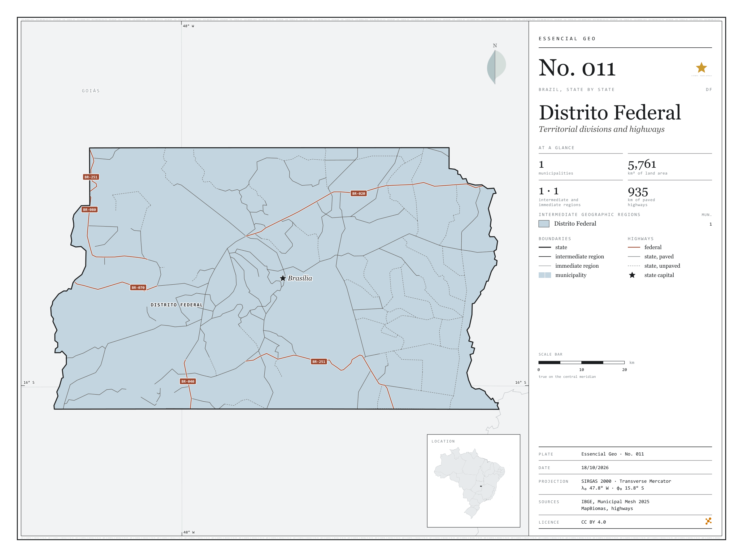
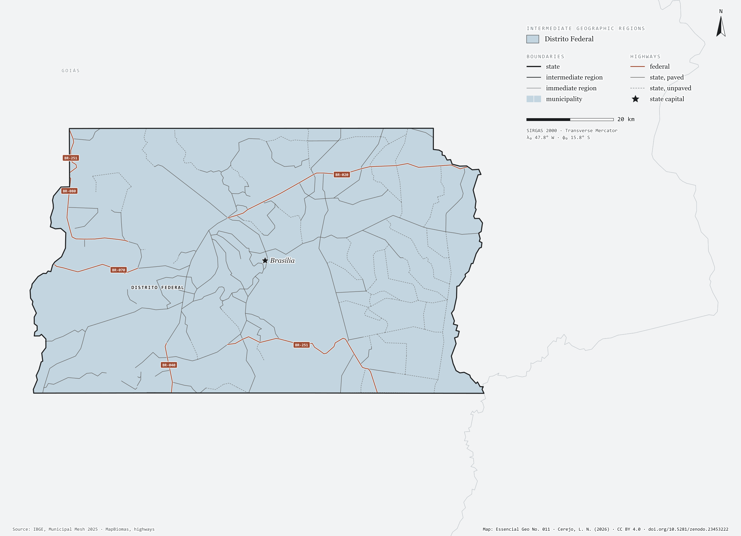
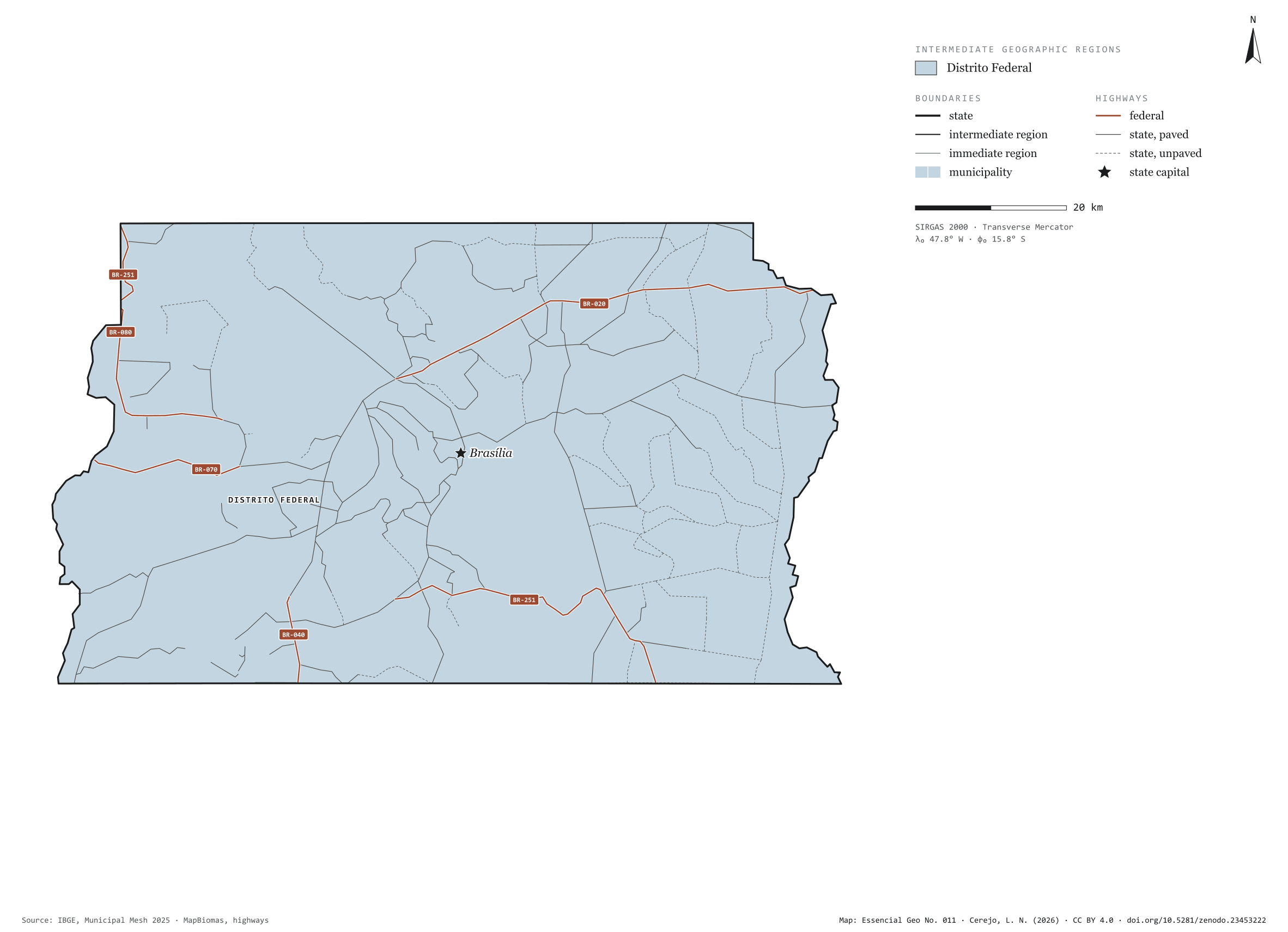
Figure to reuse
The map without a frame, with legend, scale, reference system and credit written on it: ready for papers, lectures and slides. In two versions: with the basemap (neighbours and sea) or only the mapped area, on white.
With basemap (PNG) Without basemap (PNG) QR code (SVG)
Point a camera at it to open this page.
How to cite
CEREJO, Lucas Nakamura. Distrito Federal: divisão territorial e rodovias. Versão 1.0.0. [S. l.]: Zenodo, 2026. Conjunto de dados. DOI: 10.5281/zenodo.23453222. Disponível em: https://doi.org/10.5281/zenodo.23453222. Acesso em: 10 nov. 2026.
Cerejo, L. N. (2026). Distrito Federal: divisão territorial e rodovias [Distrito Federal: Territorial divisions and highways] (Version 1.0.0) [Data set]. Zenodo. https://doi.org/10.5281/zenodo.23453222
@dataset{cerejo2026_distrito_federal,
  author    = {Cerejo, Lucas Nakamura},
  title     = {Distrito Federal: Divisão territorial e rodovias},
  year      = {2026},
  publisher = {Zenodo},
  version   = {1.0.0},
  doi       = {10.5281/zenodo.23453222},
  url       = {https://doi.org/10.5281/zenodo.23453222},
  language  = {portuguese},
  note      = {English title: Distrito Federal: Territorial divisions and highways. Licence CC BY 4.0}
}