Roraima
Territorial divisions and highways
Record, downloads and citationRoraima has 15 municipalities across 224,000 km², 2.6 per cent of Brazil. IBGE groups them into 4 immediate regions, drawn around the towns that supply jobs, trade and services to their surroundings, and into 2 intermediate regions that tie those networks together. Boa Vista is the intermediate region with the most municipalities (9); Rorainópolis - Caracaraí, the one with the fewest (6). The largest municipality is Caracaraí (47,385 km²); the smallest, São Luiz do Anauá (1,527 km²). Part of the series “Brazil, state by state”: a clean base, with official boundaries and the road network, to start a map without losing the first afternoon gathering files.
Technical record · downloads · citation
At a glance
223,505 km²
1,279 km
Layers
- municipios polygon 15 municipalities, with IBGE code, regions, urban concentration and area (km²)
- regioes_intermediarias polygon 2 intermediate geographic regions
- regioes_imediatas polygon 4 immediate geographic regions
- limite_estadual polygon Boundary of the federative unit
- rodovias line Federal and state highways: route number, surface, physical status, carriageways
- capital point Indicative point for the capital (not the exact seat)
Metadata
- Sources
- IBGE — Municipal Mesh 2025 (2025)
IBGE — Regional Division of Brazil into Immediate and Intermediate Geographic Regions (2017)
MapBiomas — Infrastructure: federal and state highways
Natural Earth — countries (plate only) - Extent
- Roraima state (RR)
- CRS / Projection
- SIRGAS 2000 (EPSG:4674)
EPSG:4674 - Software
- Python · GeoPandas · GDAL · QGIS · Node.js · d3-geo
- Method
- IBGE Municipal Mesh boundaries, dissolved into immediate and intermediate regions and the unit boundary; highways clipped to the unit.
- Version
- v1.0.0
- Licence
- CC BY 4.0
Downloads
- GPKG Six layers, SIRGAS 2000, with QGIS styles (.gpkg) 3.4 MB
- CSV Municipalities with codes and regions (.csv) 1 kB
- SVG Vector plate, for printing (.svg) 1.1 MB
- PNG Plate (PNG, 2400 px) (.png) 0.1 MB

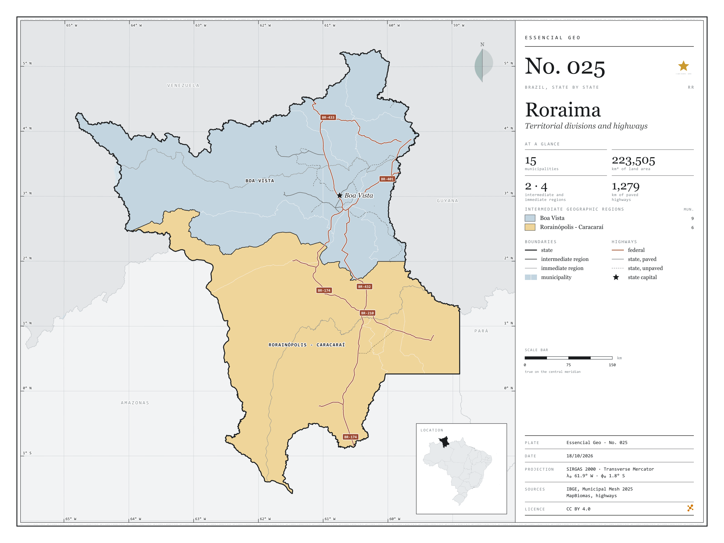
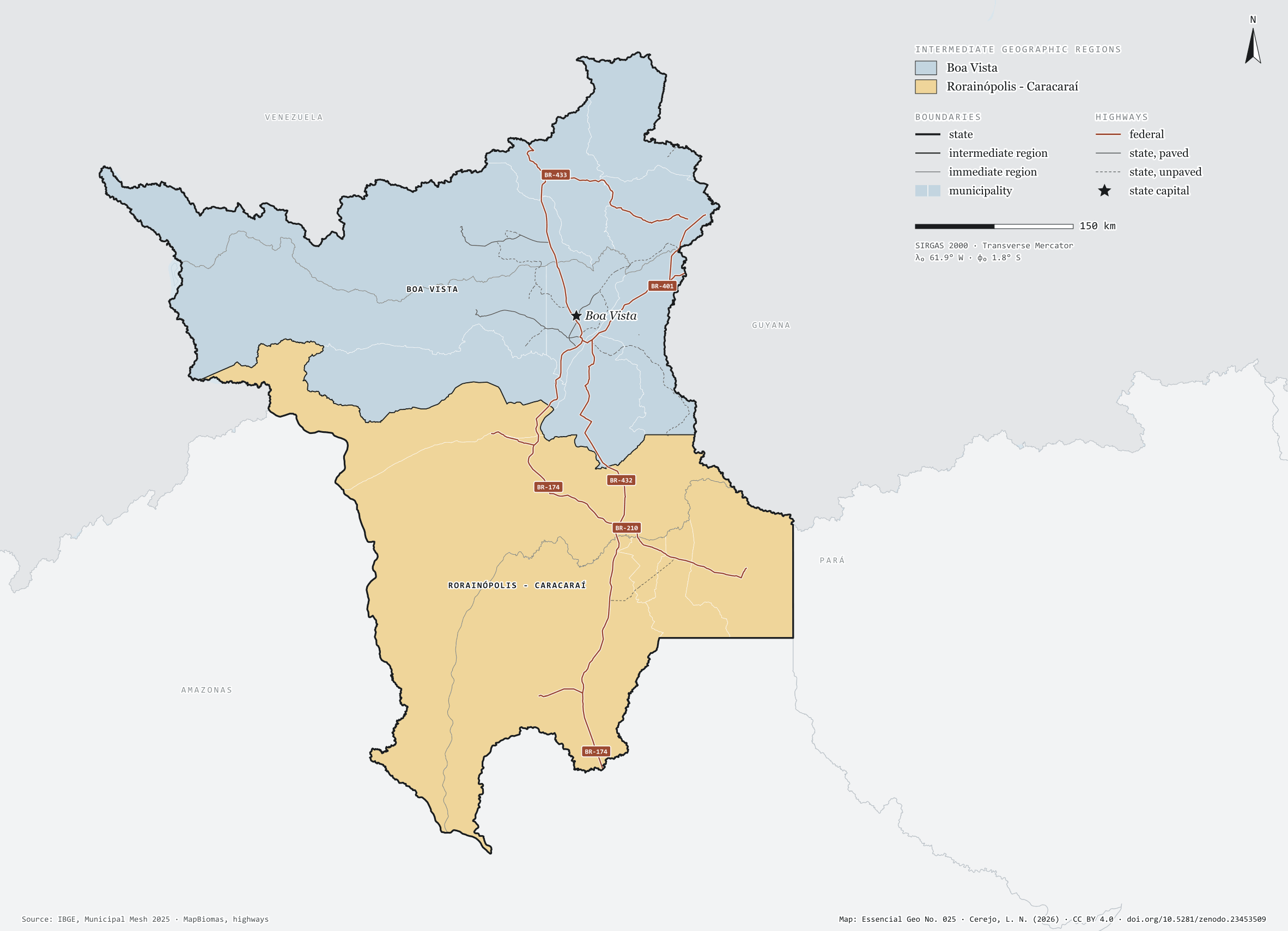
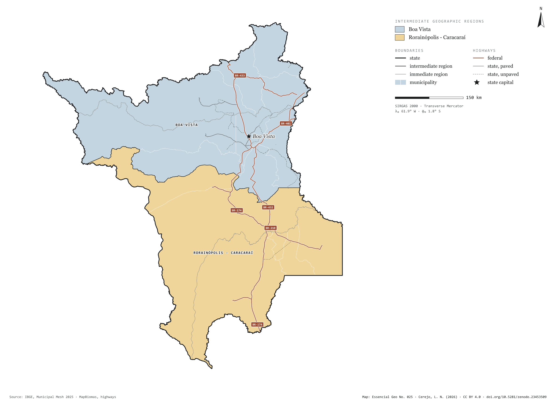
Figure to reuse
The map without a frame, with legend, scale, reference system and credit written on it: ready for papers, lectures and slides. In two versions: with the basemap (neighbours and sea) or only the mapped area, on white.
With basemap (PNG) Without basemap (PNG) QR code (SVG)
Point a camera at it to open this page.
How to cite
CEREJO, Lucas Nakamura. Roraima: divisão territorial e rodovias. Versão 1.0.0. [S. l.]: Zenodo, 2026. Conjunto de dados. DOI: 10.5281/zenodo.23453509. Disponível em: https://doi.org/10.5281/zenodo.23453509. Acesso em: 10 nov. 2026.
Cerejo, L. N. (2026). Roraima: divisão territorial e rodovias [Roraima: Territorial divisions and highways] (Version 1.0.0) [Data set]. Zenodo. https://doi.org/10.5281/zenodo.23453509
@dataset{cerejo2026_estado_roraima,
  author    = {Cerejo, Lucas Nakamura},
  title     = {Roraima: Divisão territorial e rodovias},
  year      = {2026},
  publisher = {Zenodo},
  version   = {1.0.0},
  doi       = {10.5281/zenodo.23453509},
  url       = {https://doi.org/10.5281/zenodo.23453509},
  language  = {portuguese},
  note      = {English title: Roraima: Territorial divisions and highways. Licence CC BY 4.0}
}