Drainage network
Rivers that turn their backs on the sea
Record, downloads and citationThe Tietê rises 12.5 km from the sea and runs 982 km the other way, inland, to the Paraná. It is not alone: 85.7% of the area drained by São Paulo’s rivers flows inland and on down the Paraná to the River Plate, between Argentina and Uruguay. The Serra do Mar and the Mantiqueira divide the waters. Only the coastal strip, the Ribeira de Iguape and the Paraíba do Sul valley send their rain straight to the Atlantic, through 123 river mouths on the São Paulo coast. The map draws 61,009 km of rivers, each reach as wide as its mean discharge: from headwater streams to the Paraná on the state border, with 8,490 m³/s. Second plate of the collection “Water in São Paulo”.
Technical record · downloads · citation
At a glance
- Para o interior, bacia do Prata 81.5%
- Direto para o Atlântico 18.5%
86 %
Layers
- rios line 16,999 river reaches in the state and on its border: length, upstream area, mean discharge, Strahler order and slope
- tiete line The Tietê from its source to the Paraná, 982 km
- limite_estadual polygon State boundary
Metadata
- Sources
- WWF / HydroSHEDS — HydroRIVERS v1.0, South America (Lehner and Grill, 2013)
IBGE — Municipal Mesh 2025 (2025) - Extent
- State of São Paulo (SP)
- CRS / Projection
- SIRGAS 2000 (EPSG:4674)
EPSG:4674 - Software
- Python · GeoPandas · GDAL · QGIS · Node.js · d3-geo
- Method
- HydroRIVERS reaches clipped to São Paulo, with width by modelled mean discharge and slope by the outlet of the river system; the Tietê traced from mouth to source along the reach with the largest upstream area.
- Version
- v1.0.0
- Licence
- CC BY 4.0
Downloads
- GPKG Rivers, Tietê and boundary, SIRGAS 2000, with QGIS styles (.gpkg) 2.1 MB
- CSV The 16,999 reaches, without geometry (.csv) 1.2 MB
- SVG Vector plate, for printing (.svg) 4.2 MB
- PNG Plate (PNG, 2400 px) (.png) 0.5 MB

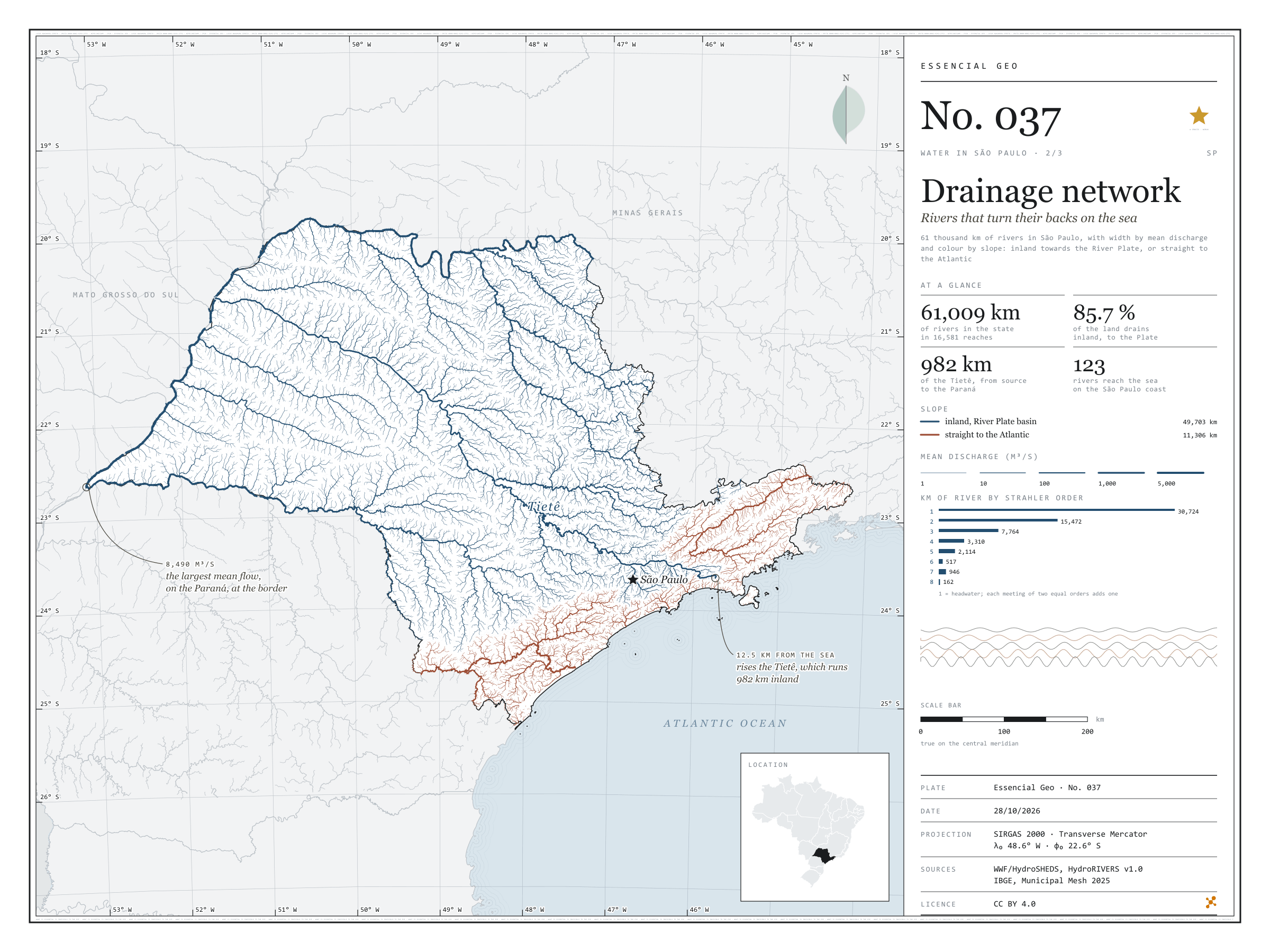
Figure to reuse
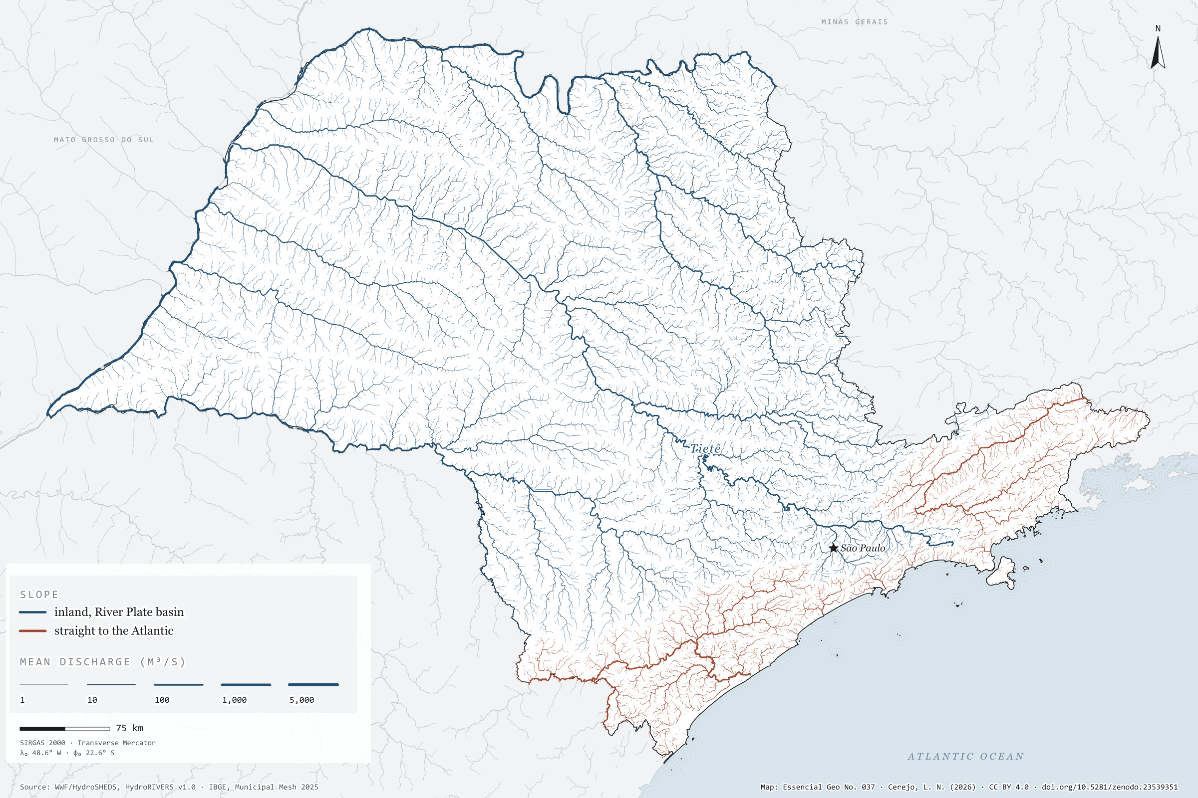
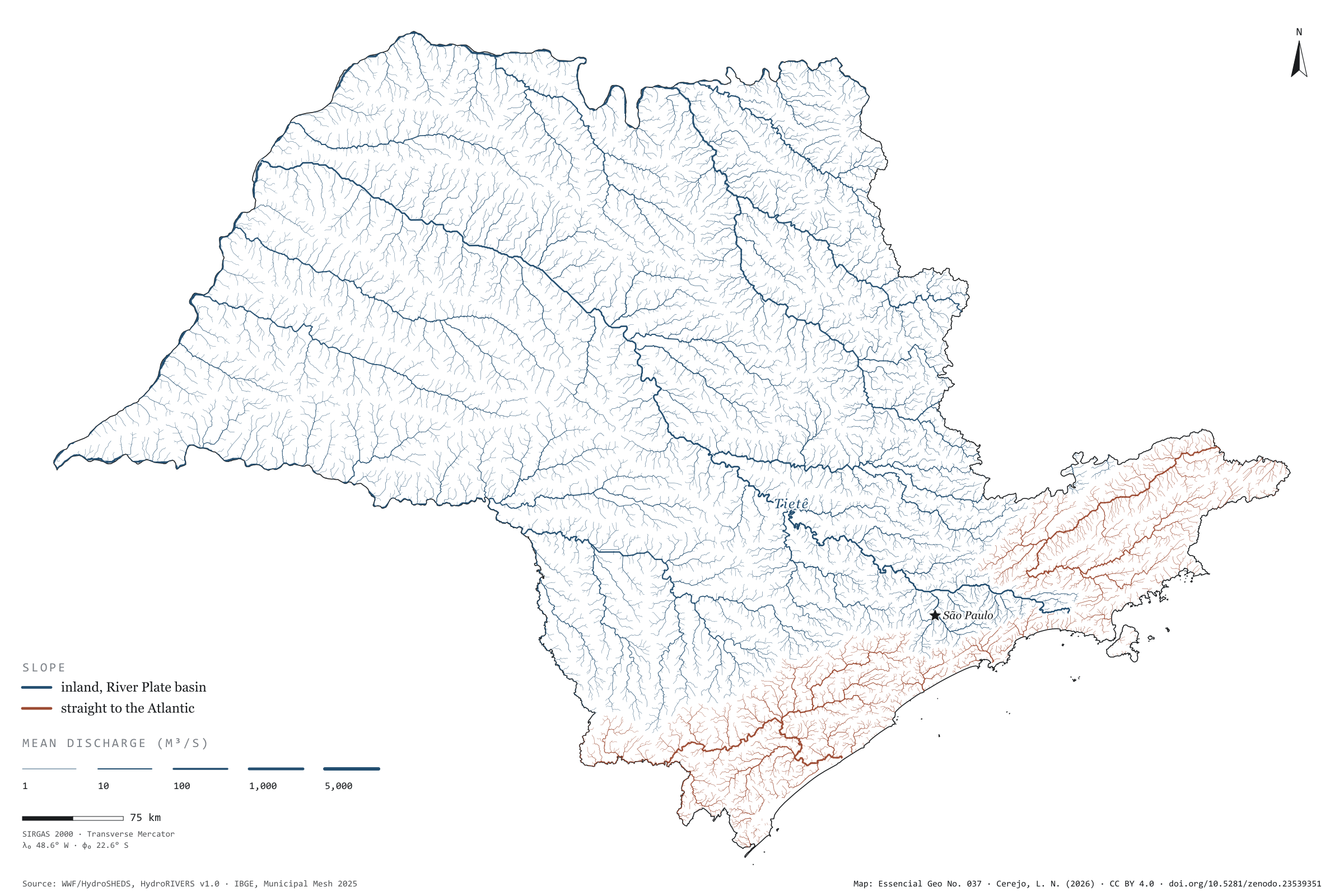
The map without a frame, with legend, scale, reference system and credit written on it: ready for papers, lectures and slides. In two versions: with the basemap (neighbours and sea) or only the mapped area, on white.
With basemap (PNG) Without basemap (PNG) QR code (SVG)
Point a camera at it to open this page.
How to cite
CEREJO, Lucas Nakamura. Rede de drenagem: os rios que dão as costas ao mar. Versão 1.0.0. [S. l.]: Zenodo, 2026. Conjunto de dados. DOI: 10.5281/zenodo.23539351. Disponível em: https://doi.org/10.5281/zenodo.23539351. Acesso em: 10 nov. 2026.
Cerejo, L. N. (2026). Rede de drenagem: os rios que dão as costas ao mar [Drainage network: Rivers that turn their backs on the sea] (Version 1.0.0) [Data set]. Zenodo. https://doi.org/10.5281/zenodo.23539351
@dataset{cerejo2026_drenagem_sp,
  author    = {Cerejo, Lucas Nakamura},
  title     = {Rede de drenagem: Os rios que dão as costas ao mar},
  year      = {2026},
  publisher = {Zenodo},
  version   = {1.0.0},
  doi       = {10.5281/zenodo.23539351},
  url       = {https://doi.org/10.5281/zenodo.23539351},
  language  = {portuguese},
  note      = {English title: Drainage network: Rivers that turn their backs on the sea. Licence CC BY 4.0}
}