Transmission lines
The wires that stitch the country together
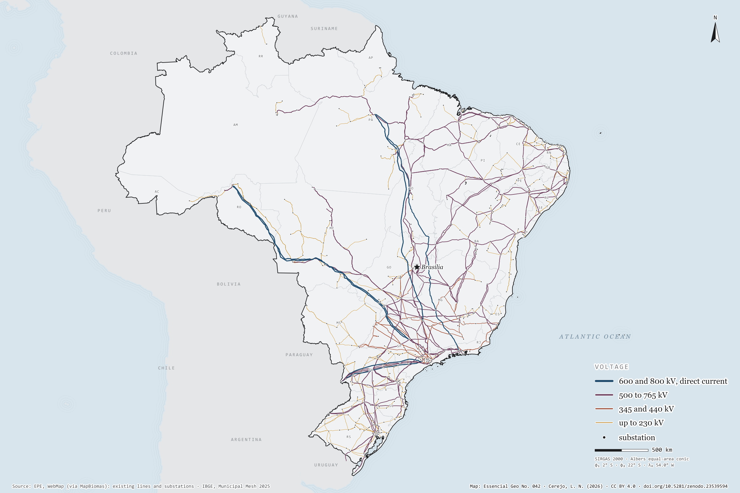
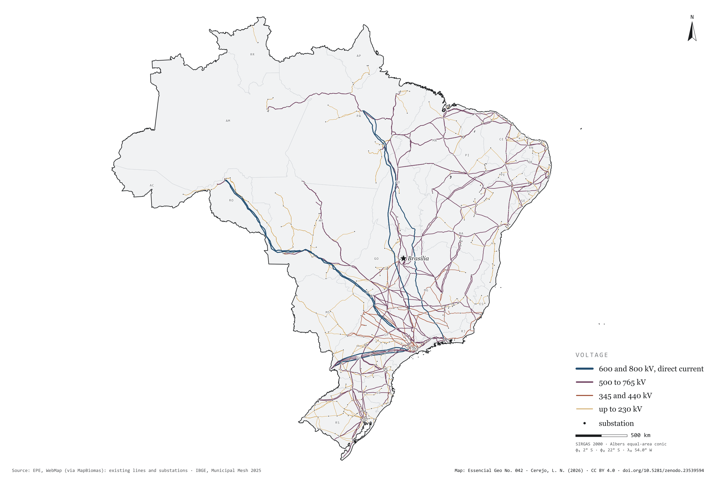
Record, downloads and citationFrom the Xingu to Rio de Janeiro, an 800 kV direct-current line runs 2,552 km to carry Belo Monte’s power to the South-East: it is the longest of the 1,712 existing transmission lines mapped by EPE. Adding up circuits, they come to 170.2 thousand km of lines and 780 substations. Lines of 500 to 765 kV make up most of the length, 68.0 thousand km; the eleven direct-current lines, 19.5 thousand km, bring the power of Itaipu, the Madeira plants and Belo Monte to the South-East. On the map, the grid thickens in the South-East, the South and along the north-eastern coast, and reaches the Amazon through a handful of wires. First plate of the collection “Electricity in Brazil”.
Technical record · downloads · citation
At a glance
2,552 km
Layers
- linhas_transmissao line 1,712 lines: voltage, length, year in service, concession holder and voltage class
- subestacoes point 780 substations: voltages, year in service, concession holder and state
- ufs polygon 27 states
- limite_nacional polygon National boundary
Metadata
- Sources
- EPE — WebMap: existing transmission lines and substations, as published in the MapBiomas infrastructure database (2022)
IBGE — Municipal Mesh 2025 (state and national boundaries) (2025)
Natural Earth — neighbouring countries (via world-atlas) - Extent
- Brazil
- CRS / Projection
- SIRGAS 2000 (EPSG:4674)
EPSG:4674 - Software
- Python · GeoPandas · GDAL · QGIS · Node.js · d3-geo
- Method
- EPE’s existing transmission lines and substations, grouped into four voltage classes; length as declared by EPE and checked against the geodesic measurement.
- Version
- v1.0.0
- Licence
- CC BY 4.0
Downloads
- GPKG Four layers, SIRGAS 2000, with QGIS styles (.gpkg) 3.3 MB
- CSV All 1,712 lines, without geometry (.csv) 0.2 MB
- SVG Vector plate, for printing (.svg) 3.8 MB
- PNG Plate (PNG, 2400 px) (.png) 0.3 MB

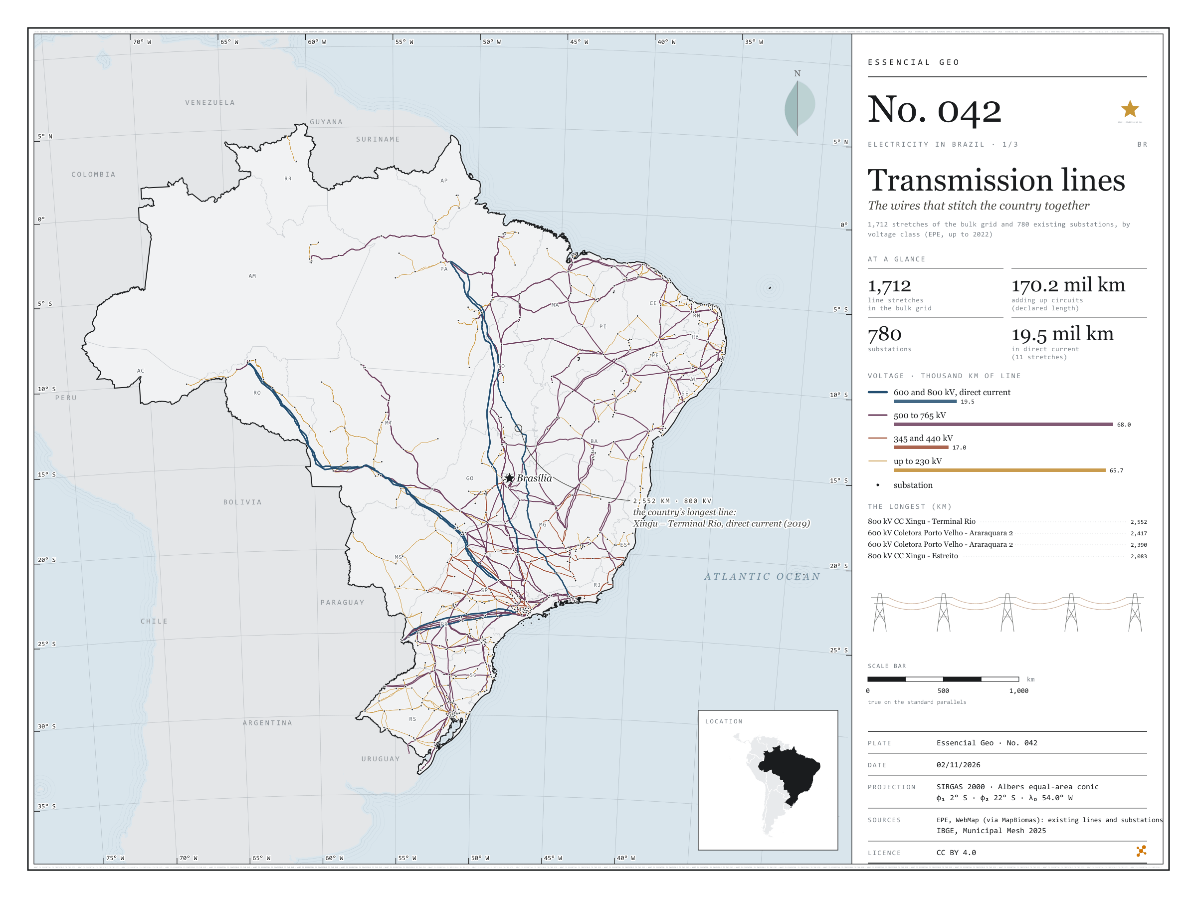
Figure to reuse
The map without a frame, with legend, scale, reference system and credit written on it: ready for papers, lectures and slides. In two versions: with the basemap (neighbours and sea) or only the mapped area, on white.
With basemap (PNG) Without basemap (PNG) QR code (SVG)
Point a camera at it to open this page.
How to cite
CEREJO, Lucas Nakamura. Linhas de transmissão: os fios que costuram o país. Versão 1.0.0. [S. l.]: Zenodo, 2026. Conjunto de dados. DOI: 10.5281/zenodo.23539594. Disponível em: https://doi.org/10.5281/zenodo.23539594. Acesso em: 10 nov. 2026.
Cerejo, L. N. (2026). Linhas de transmissão: os fios que costuram o país [Transmission lines: The wires that stitch the country together] (Version 1.0.0) [Data set]. Zenodo. https://doi.org/10.5281/zenodo.23539594
@dataset{cerejo2026_transmissao_brasil,
  author    = {Cerejo, Lucas Nakamura},
  title     = {Linhas de transmissão: Os fios que costuram o país},
  year      = {2026},
  publisher = {Zenodo},
  version   = {1.0.0},
  doi       = {10.5281/zenodo.23539594},
  url       = {https://doi.org/10.5281/zenodo.23539594},
  language  = {portuguese},
  note      = {English title: Transmission lines: The wires that stitch the country together. Licence CC BY 4.0}
}