The favelas of the metropolis
On the banks, the slopes and the mangroves
Record, downloads and citationSeen tract by tract, the favelas of Greater São Paulo and the Santos coast are not one patch but hundreds of fragments on valley floors, hillsides and the edges of reservoirs, streams and mangroves. The map window, from Francisco Morato to Guarujá, holds 92% of the state’s favela residents, in 2,747 communities across 51 municipalities. The two largest are in the capital: Paraisópolis, with 59,000 residents, beside Morumbi, and Heliópolis, with 56,000, in the south, next to São Caetano do Sul. Then come Vila São Pedro, in São Bernardo do Campo, with 28,000, and Chafik/Macuco and Jardim Oratório, in Mauá. In the state, only 19 favelas exceed 10,000 residents, with 403,000 people between them; most are small: 2,167 have fewer than 1,000 residents, and the bulk of the population, 1.78 million, lives in the 876 with 1,000 to 5,000.
Technical record · downloads · citation
At a glance
- under 1,000 26%
- 1,000 to 5,000 49.1%
- 5,000 to 10,000 13.8%
- over 10,000 11.1%
92 %
58,527 people
Layers
- setores_fcu polygon 8,008 tracts in Favelas and Urban Communities: community code and name, municipality, people and occupied households
- municipios polygon 645 municipalities: people, people in favelas, number of communities and population share
- regioes_intermediarias polygon 11 intermediate geographic regions
- limite_estadual polygon State boundary
Metadata
- Sources
- IBGE — 2022 Population Census: census tract aggregates (basic characteristics), with the Favelas and Urban Communities identifier (2022)
IBGE — 2022 Census Tract Mesh (2022)
IBGE — Municipal Mesh 2025 (2025) - Extent
- Greater São Paulo and the Santos coast (SP)
- CRS / Projection
- SIRGAS 2000 (EPSG:4674)
EPSG:4674 - Software
- Node.js · d3-geo · QGIS
- Method
- Census tracts coded as a Favela or Urban Community in the 2022 Census aggregates, drawn over the municipal mesh; residents of each community = sum of people in its tracts.
- Version
- v1.0.0
- Licence
- CC BY 4.0
Downloads
- GPKG Favela tracts and municipalities, SIRGAS 2000, with QGIS styles (.gpkg) 5.5 MB
- CSV List of the 3,136 favelas and communities, with residents and coordinates (.csv) 240 kB
- SVG Vector plate, for printing (.svg) 2.0 MB
- PNG Plate (PNG, 2400 px) (.png) 0.3 MB

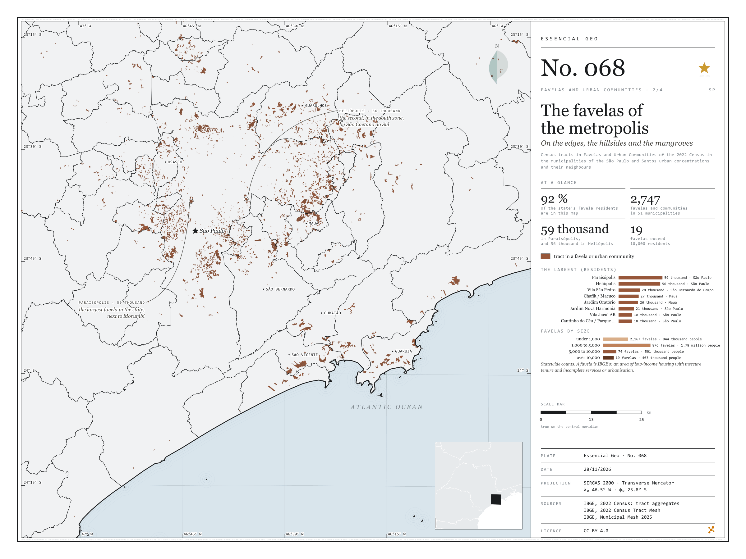
Figure to reuse
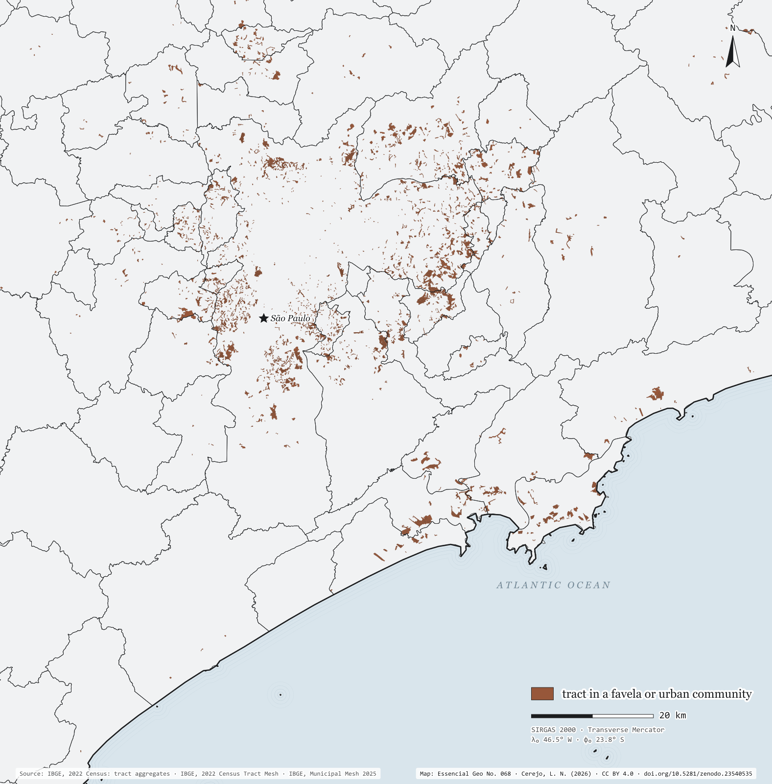
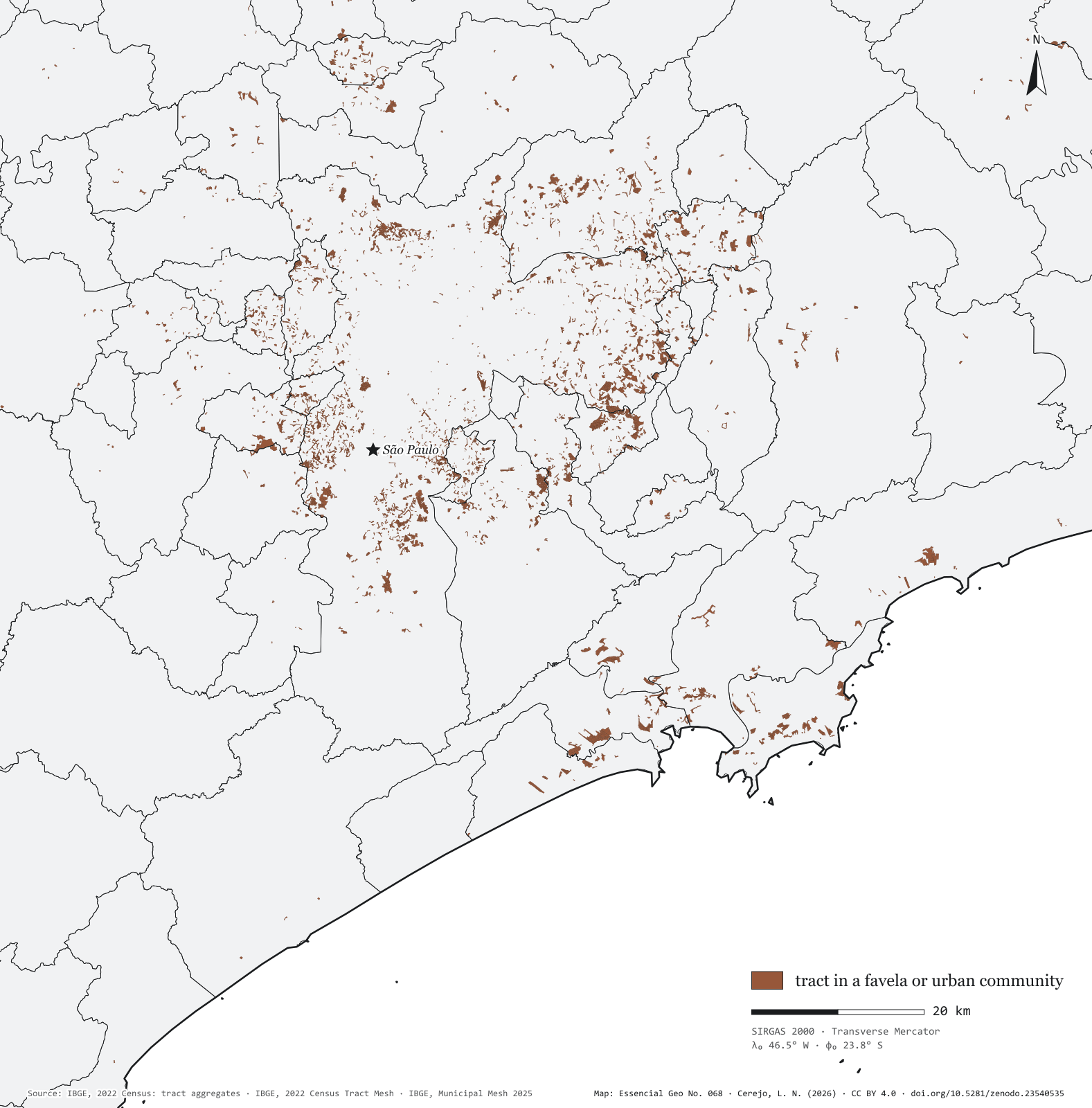
The map without a frame, with legend, scale, reference system and credit written on it: ready for papers, lectures and slides. In two versions: with the basemap (neighbours and sea) or only the mapped area, on white.
With basemap (PNG) Without basemap (PNG) QR code (SVG)
Point a camera at it to open this page.
How to cite
CEREJO, Lucas Nakamura. As favelas da metrópole: nas margens, nas encostas e nos mangues. Versão 1.0.0. [S. l.]: Zenodo, 2026. Conjunto de dados. DOI: 10.5281/zenodo.23540535. Disponível em: https://doi.org/10.5281/zenodo.23540535. Acesso em: 10 nov. 2026.
Cerejo, L. N. (2026). As favelas da metrópole: nas margens, nas encostas e nos mangues [The favelas of the metropolis: On the banks, the slopes and the mangroves] (Version 1.0.0) [Data set]. Zenodo. https://doi.org/10.5281/zenodo.23540535
@dataset{cerejo2026_favelas_na_metropole_sp,
  author    = {Cerejo, Lucas Nakamura},
  title     = {As favelas da metrópole: Nas margens, nas encostas e nos mangues},
  year      = {2026},
  publisher = {Zenodo},
  version   = {1.0.0},
  doi       = {10.5281/zenodo.23540535},
  url       = {https://doi.org/10.5281/zenodo.23540535},
  language  = {portuguese},
  note      = {English title: The favelas of the metropolis: On the banks, the slopes and the mangroves. Licence CC BY 4.0}
}