Sugarcane
A green sea over a fifth of the state
Record, downloads and citationIn 2024, São Paulo’s cane fields were harvested over 5.40 million hectares, 21.7% of the state, and yielded 418.6 million tonnes of cane. In 88 municipalities the harvested area exceeds half the territory; in Areiópolis it reaches 82%, and in Jaboticabal 81%. The map shows the dark patch that covers the north and centre of the state and has Morro Agudo as its largest producer (7.0 million tonnes), and it shows where the patch ends: in the Paraíba valley, the Ribeira valley and Greater São Paulo, cane all but disappears. Every tonne harvested leaves bagasse and straw, and every litre of ethanol leaves vinasse; this is the map São Paulo’s bioenergy rests on. Third plate of the collection “Bioenergy in São Paulo”.
Technical record · downloads · citation
At a glance
5,398,676 ha
418,569,112 t
Layers
- municipios polygon 645 municipalities: harvested area (ha), production (t), share of territory (%) and yield (t/ha)
- regioes_intermediarias polygon 11 intermediate geographic regions
- limite_estadual polygon State boundary
Metadata
- Sources
- IBGE — Municipal Agricultural Production (PAM), table 1612: temporary crops (2024)
IBGE — Municipal Mesh 2025 (2025) - Extent
- São Paulo state (SP)
- CRS / Projection
- SIRGAS 2000 (EPSG:4674)
EPSG:4674 - Software
- Python · GeoPandas · GDAL · QGIS · Node.js · d3-geo
- Method
- Harvested area and production of sugarcane from PAM 2024 joined to the Municipal Mesh by IBGE code; harvested area divided by municipal area, in six quantile classes.
- Version
- v1.0.0
- Licence
- CC BY 4.0
Downloads
- GPKG Three layers, SIRGAS 2000, with QGIS styles (.gpkg) 18.5 MB
- CSV Harvested area, production and yield by municipality (.csv) 46 kB
- SVG Vector plate, for printing (.svg) 2.2 MB
- PNG Plate (PNG, 2400 px) (.png) 0.3 MB

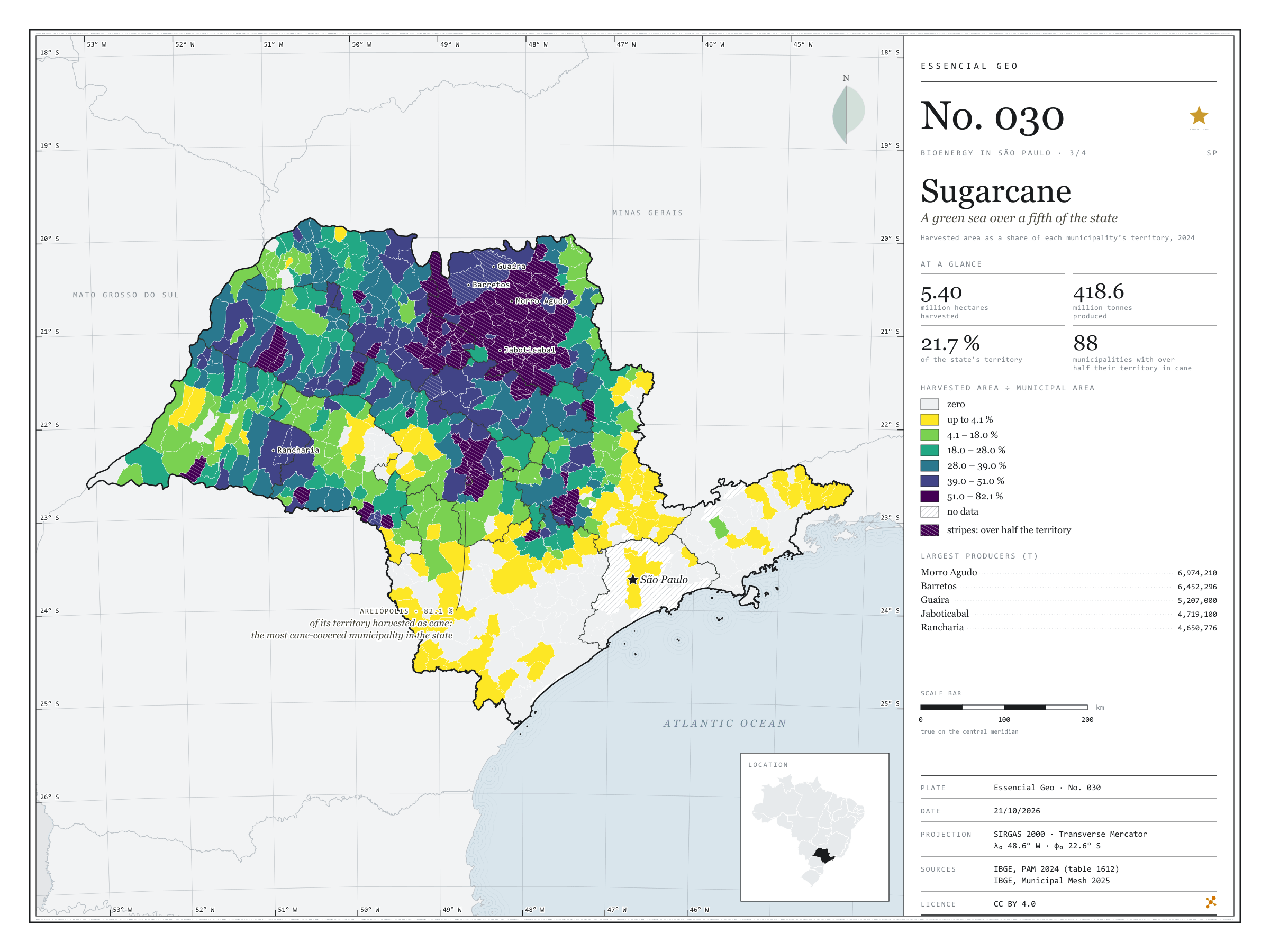
Figure to reuse
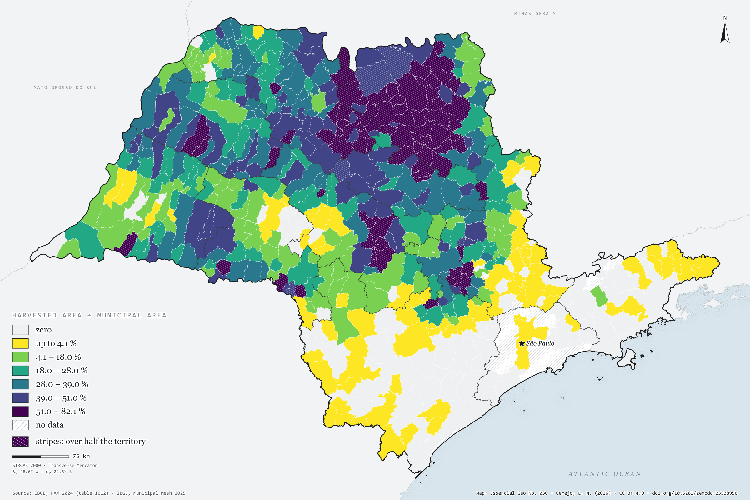
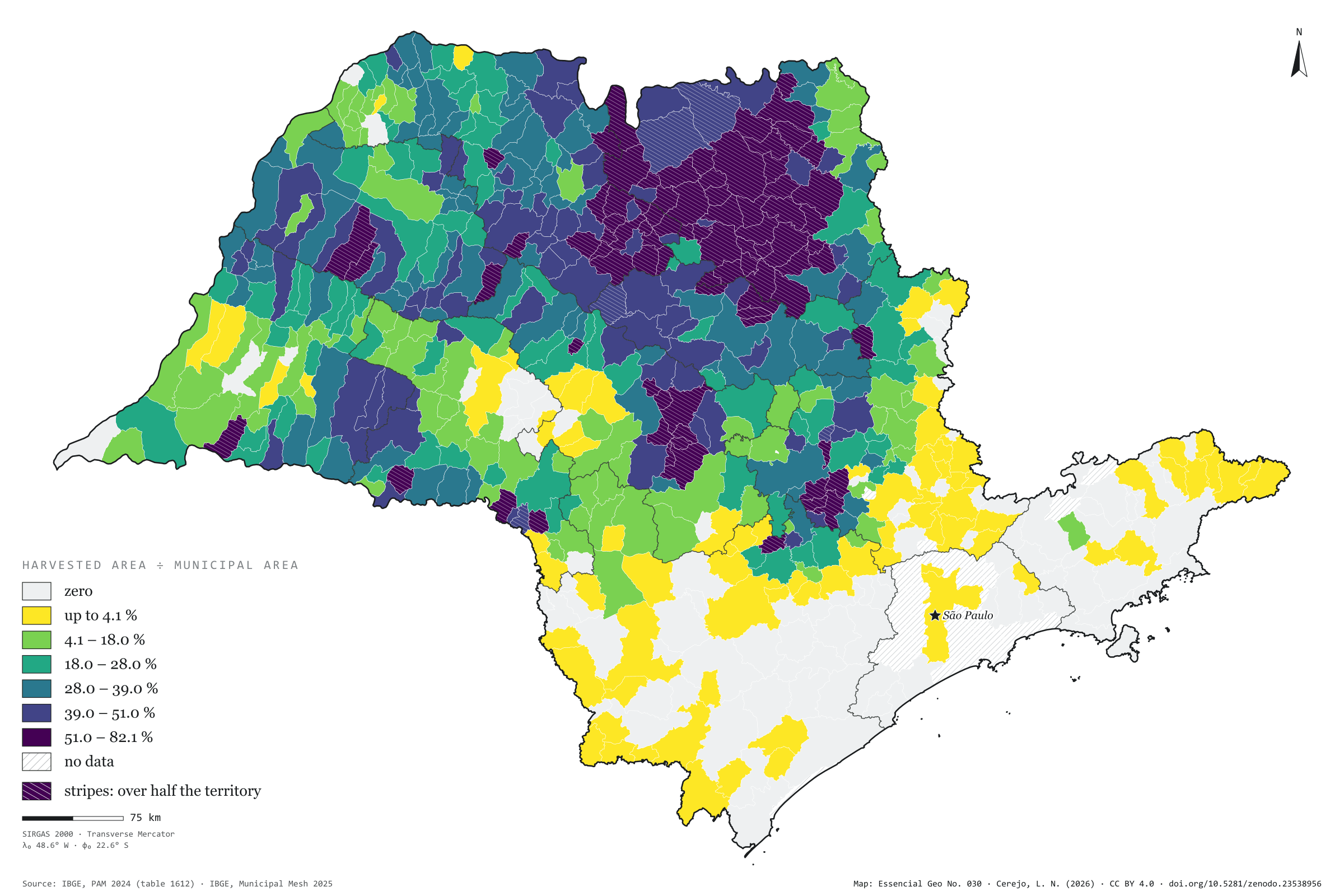
The map without a frame, with legend, scale, reference system and credit written on it: ready for papers, lectures and slides. In two versions: with the basemap (neighbours and sea) or only the mapped area, on white.
With basemap (PNG) Without basemap (PNG) QR code (SVG)
Point a camera at it to open this page.
How to cite
CEREJO, Lucas Nakamura. Cana-de-açúcar: um mar verde sobre um quinto do estado. Versão 1.0.0. [S. l.]: Zenodo, 2026. Conjunto de dados. DOI: 10.5281/zenodo.23538956. Disponível em: https://doi.org/10.5281/zenodo.23538956. Acesso em: 10 nov. 2026.
Cerejo, L. N. (2026). Cana-de-açúcar: um mar verde sobre um quinto do estado [Sugarcane: A green sea over a fifth of the state] (Version 1.0.0) [Data set]. Zenodo. https://doi.org/10.5281/zenodo.23538956
@dataset{cerejo2026_cana_de_acucar_sp,
  author    = {Cerejo, Lucas Nakamura},
  title     = {Cana-de-açúcar: Um mar verde sobre um quinto do estado},
  year      = {2026},
  publisher = {Zenodo},
  version   = {1.0.0},
  doi       = {10.5281/zenodo.23538956},
  url       = {https://doi.org/10.5281/zenodo.23538956},
  language  = {portuguese},
  note      = {English title: Sugarcane: A green sea over a fifth of the state. Licence CC BY 4.0}
}