The farming patchwork
Almost a quarter of the state is sugarcane
Record, downloads and citationIn 2024, 72% of São Paulo’s territory was cropland, pasture, tree plantation or a mosaic of these uses, according to MapBiomas. Sugarcane is the largest class: 58,000 km², almost a quarter of the state, and the leading use in 255 of the 645 municipalities. In the Ribeirão Preto region it covers half the land, and in Dumont, 80%. Soybean and other annual crops add up to 7%, mostly in the south, in the Marília region and around Itapeva. Pasture, at 15%, dominates the west: it covers 36% of the Presidente Prudente region. Oranges, coffee and other perennial crops take up less than 2%. Native vegetation, 22% of the state, lies mostly in the Serra do Mar and the Ribeira valley. First plate of the collection “From field to biomethane”, which follows the crops to the gas their residues could give.
Technical record · downloads · citation
At a glance
- Sugarcane 23.4%
- Native vegetation 21.5%
- Mosaic of uses 20.1%
- Pasture 15.5%
- Soybean and other annual crops 7.3%
- Tree plantation 4.1%
- Urban area 3.5%
- Water 2.5%
- Citrus, coffee and other perennials 2%
- Other non-vegetated areas 0.2%
Layers
- municipios polygon 645 municipalities: area (km²) and share of the municipality (%) of each of the eleven classes, total of farming uses and class with the largest area
- regioes_intermediarias polygon 11 intermediate geographic regions
- limite_estadual polygon State boundary
Metadata
- Sources
- MapBiomas — Collection 10 of the Annual Series of Land Use and Land Cover Maps of Brazil, 2024 (2024)
IBGE — Municipal Mesh 2025 (2025) - Extent
- São Paulo state (SP)
- CRS / Projection
- SIRGAS 2000 (EPSG:4674)
EPSG:4674 - Software
- Python · rasterio · GeoPandas · GDAL · QGIS · Node.js · d3-geo
- Method
- MapBiomas 2024 classification (Collection 10), 30 m pixels, grouped into eleven classes; areas by municipality counted on the 30 m pixels, on the GRS80 ellipsoid; map drawn with the most frequent class in blocks of 4 × 4 pixels (120 m).
- Version
- v1.0.0
- Licence
- CC BY 4.0
Downloads
- GPKG Three layers, SIRGAS 2000, with QGIS styles (.gpkg) 18.6 MB
- TIF 2024 classification for SP (GeoTIFF, 120 m) with a .qml style (.tif) 3.9 MB
- CSV Area of each class by municipality (.csv) 110 kB
- SVG Vector plate, for printing (.svg) 3.2 MB
- PNG Plate (PNG, 2400 px) (.png) 0.6 MB

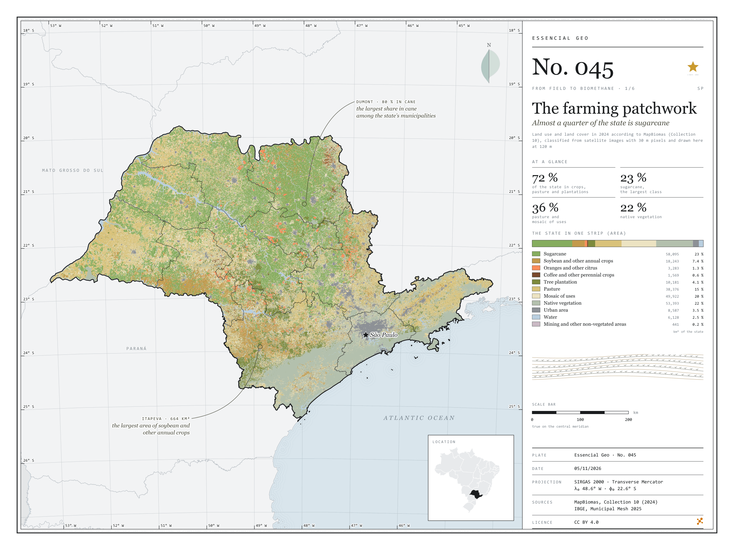
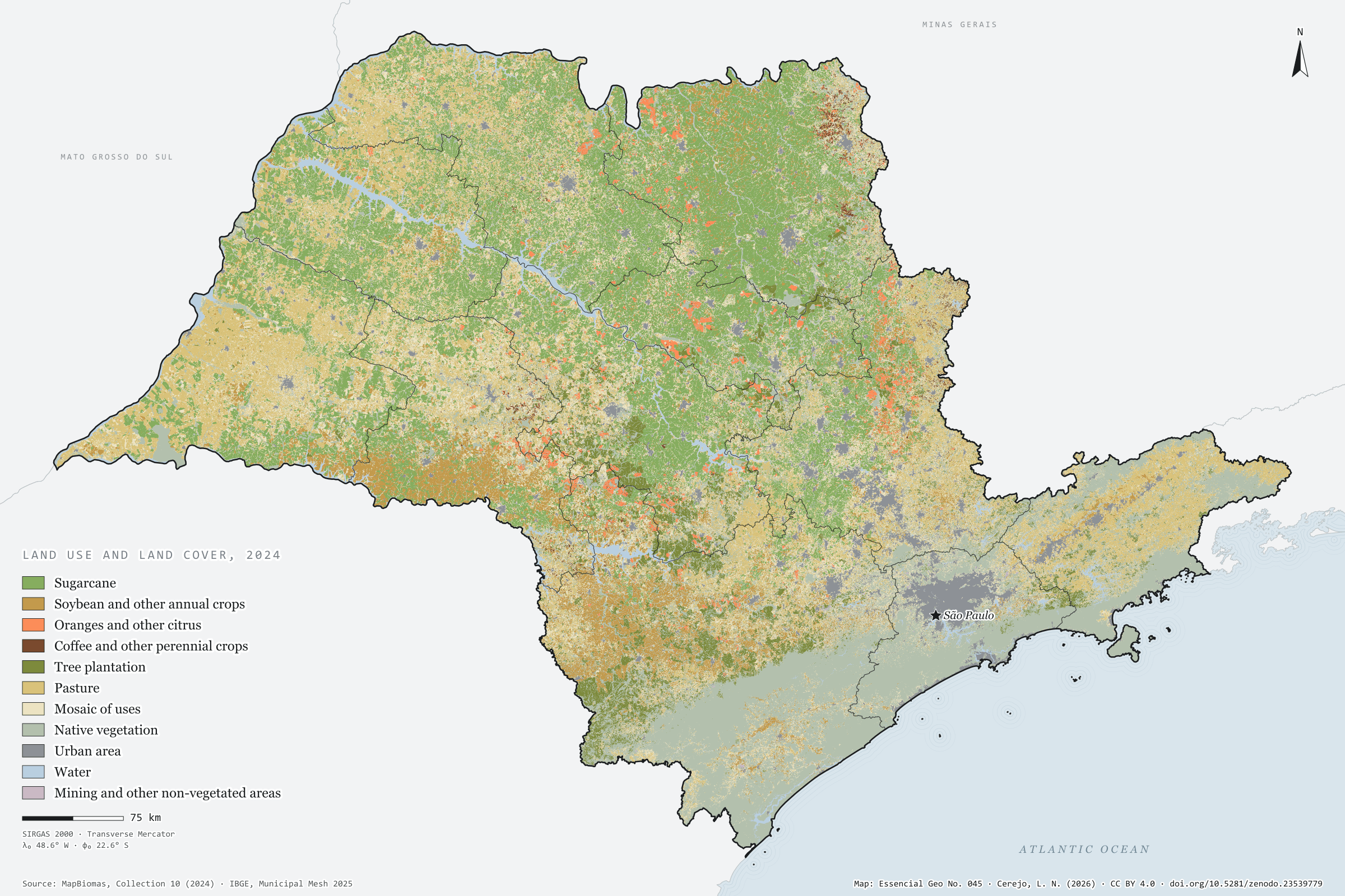
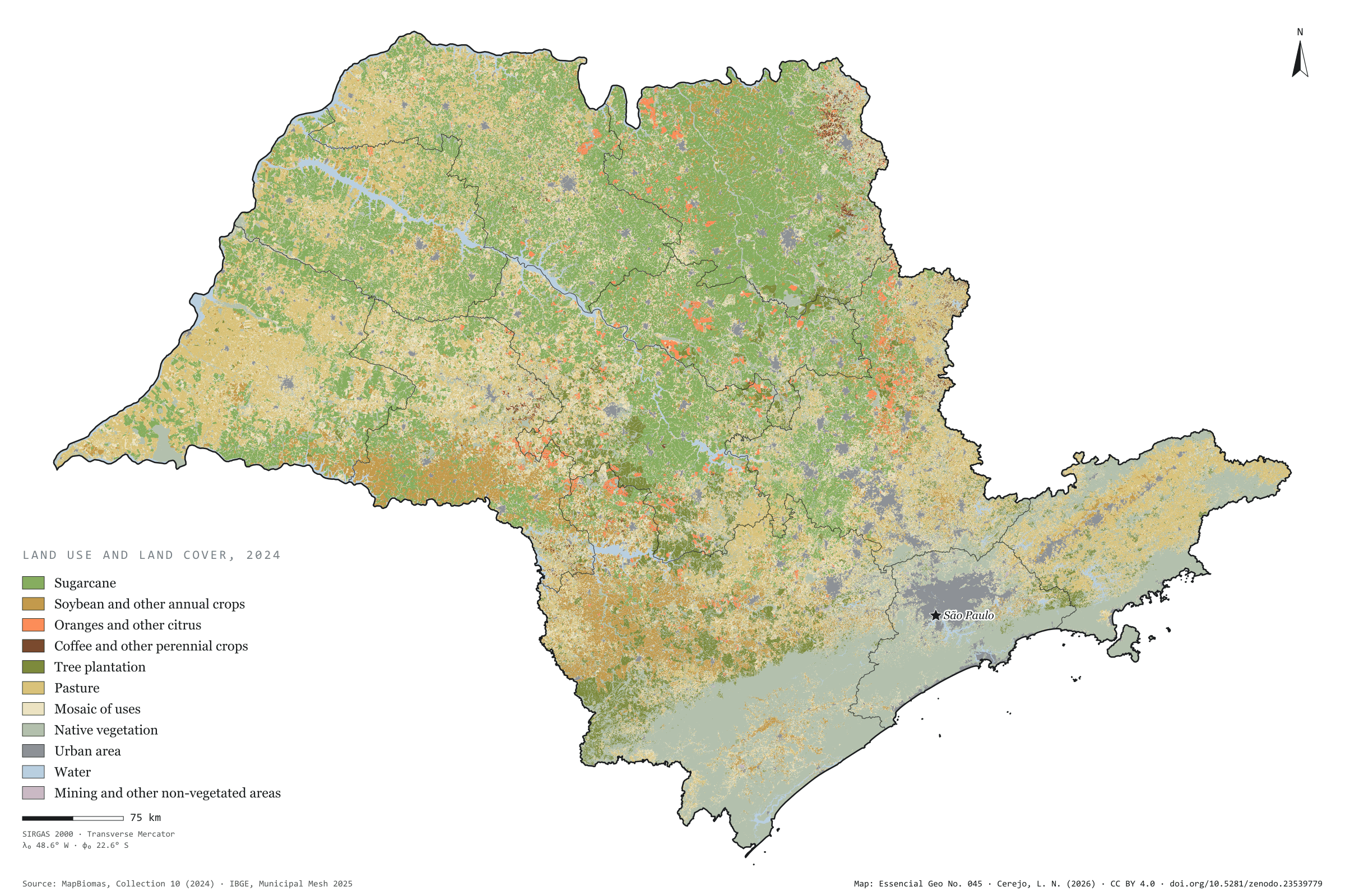
Figure to reuse
The map without a frame, with legend, scale, reference system and credit written on it: ready for papers, lectures and slides. In two versions: with the basemap (neighbours and sea) or only the mapped area, on white.
With basemap (PNG) Without basemap (PNG) QR code (SVG)
Point a camera at it to open this page.
How to cite
CEREJO, Lucas Nakamura. O tabuleiro agrícola: quase um quarto do estado é cana. Versão 1.0.0. [S. l.]: Zenodo, 2026. Conjunto de dados. DOI: 10.5281/zenodo.23539779. Disponível em: https://doi.org/10.5281/zenodo.23539779. Acesso em: 10 nov. 2026.
Cerejo, L. N. (2026). O tabuleiro agrícola: quase um quarto do estado é cana [The farming patchwork: Almost a quarter of the state is sugarcane] (Version 1.0.0) [Data set]. Zenodo. https://doi.org/10.5281/zenodo.23539779
@dataset{cerejo2026_tabuleiro_agricola_sp,
  author    = {Cerejo, Lucas Nakamura},
  title     = {O tabuleiro agrícola: Quase um quarto do estado é cana},
  year      = {2026},
  publisher = {Zenodo},
  version   = {1.0.0},
  doi       = {10.5281/zenodo.23539779},
  url       = {https://doi.org/10.5281/zenodo.23539779},
  language  = {portuguese},
  note      = {English title: The farming patchwork: Almost a quarter of the state is sugarcane. Licence CC BY 4.0}
}